Rocky Mountain National Park
is an American national park located approximately 76 mi (122 km) north-west of Denver International Airport in north-central Colorado, within the Front Range of the Rocky Mountains. The park is situated between the towns of Estes Park to the east and Grand Lake to the west. The eastern and western slopes of the Continental Divide run directly through the centre of the park with the headwaters of the Colorado River located in the park’s northwestern region.
The main features of the park include mountains, alpine lakes and a wide variety of wildlife within various climates and environments, from wooded forests to mountain tundra. The Rocky Mountain National Park Act was signed by President Woodrow Wilson on January 26, 1915, establishing the park boundaries and protecting the area for future generations. The Civilian Conservation Corps built the main automobile route, Trail Ridge Road, in the 1930s. In 1976, UNESCO designated the park as one of the first World Biosphere Reserves. In 2018, more than 4.5 million recreational visitors entered the park. The park is one of the most visited in the National Park System, ranking as the third most visited national park in 2015. In 2019, the park saw record attendance yet again with 4,678,804 visitors, a 44% increase since 2012.
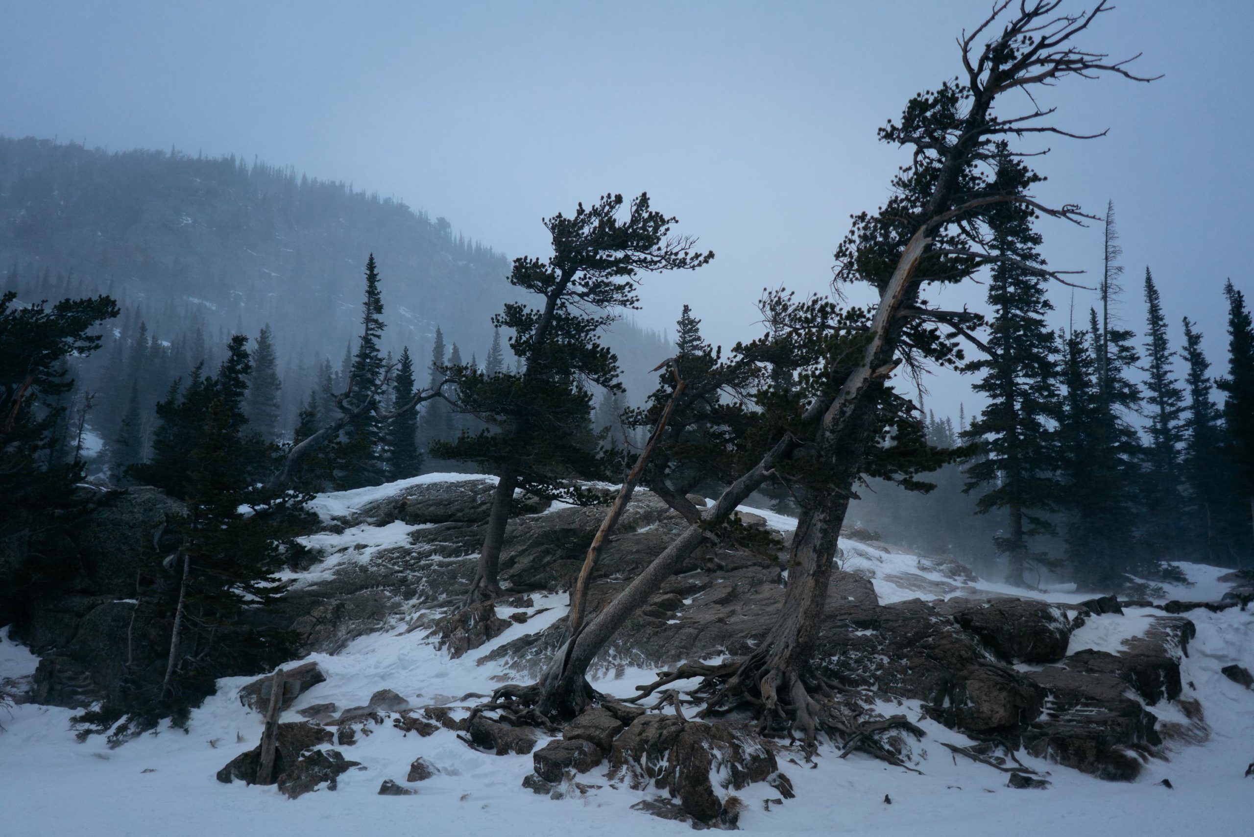
Dream lake, Rocky Mountain NP, USA
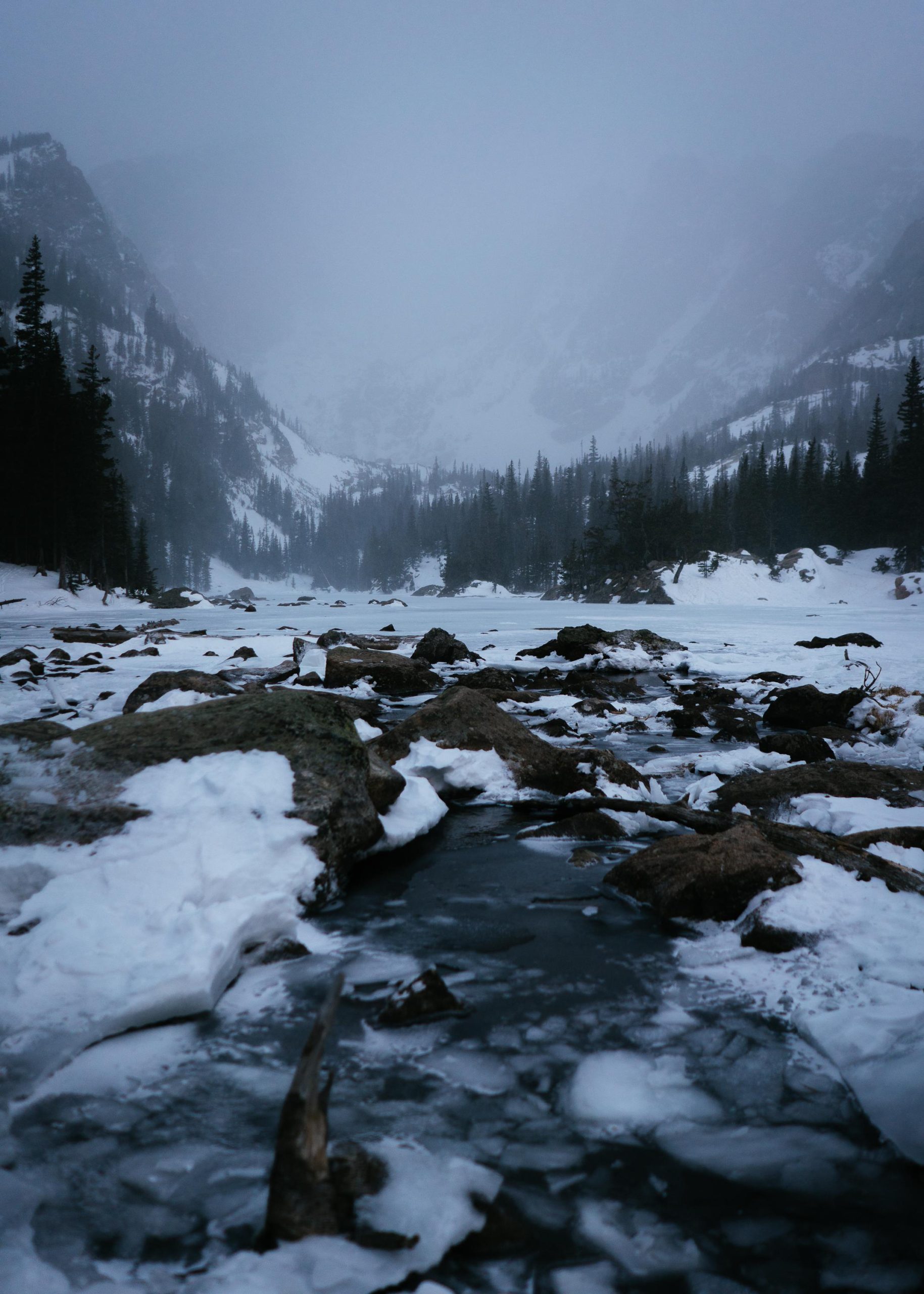
I went to Dream lake for sunrise and the closer I got to the lake the heavier wind and snowfall got. Once I made it to the lake they were so strong it was a bit funny and scary thinking about the 2 hour hike back. Looking at the photo it feels like the wind bend the trees just at that moment, so strong was the storm, but its been blowing and storming in this direction for centuries I guess.
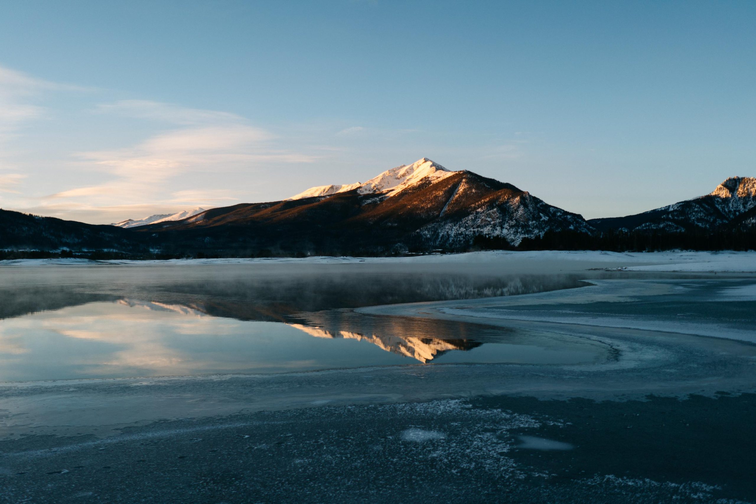
I left the Black Canyon of the Gunnison around noon, got some well deserved gas station coffee in town and got on my way to the west side of the Rocky Mountain national park. It was a long drive crossing many passes and valleys, which meant going up and down and up and down, some were as high as 3500m. It got slippery at night, I couldn’t make the journey comfortable in one day, so I had a stopover in Frisco.
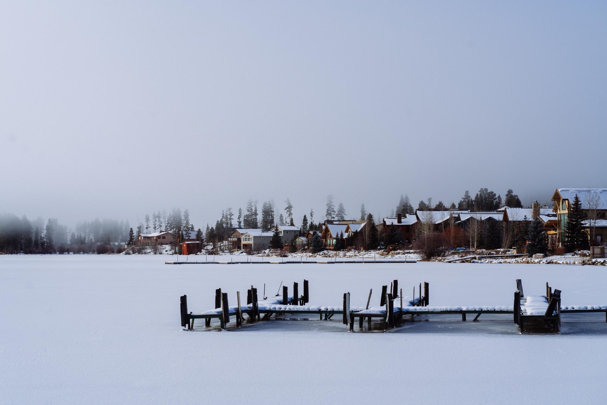
Impossible to sleep in the car with nightly temperatures of around about -15C, so I decided to stay in the world famous snow shoe motel, it had been on TV. It was pricey yet again but well worth the warm night and the only option around town in the sub 100$ category. I did get up for sunrise and went to the towns lake. It was pretty random, just a lake close to the city. It turned out to be one of the coldest mornings of the trip, not only my fingers but also my toes really started to freeze in my summer shoes. I stumbled around the icy lake for a bit but called it early because it was just too cold, the lake wasn’t too Interesting and my feet were wet. To reward my efforts the town of Frisco reposted the photo I shot for @mvglive on their Instagram. I went back to the motel and had breakfast, I needed to stock up on food to make up for the prices of the hotel. I left early for the last leg of my journey to the Rocky Mountain national park. I had planned (for once) to stay on the west side for a couple of days, explore this side of the park and then take the pass, basically through the middle over the mountains, to the east side of the park. The road that connected the two parks through the mountain range and the hikes that were to be done there were the highlights of the park. Sadly it was closed. I did visit both sides in the end, but missed crossing the ridge, due to closed roads and heavy winter weather. Maybe missing this road was for the best with the breaks and all that. Without the road there wasn’t much to do in Grand lake, as most of the hikes on this side of the park were closed. I enjoyed the hotel I had booked for myself, very comfortable and warm. A bit classier than the average road motel, a family run business with tasteful furniture, lots of space and even a sofa. I hadn’t had one in a long time and so I stayed on the couch… a lot. I did leave the house to get groceries and try a hike here and there (or at least drive to the trailhead) and have a look at the town, but I mostly stayed in the warm crib and watched tv, did some organizing, work and ate lots of chocolate. I must say the temperatures were very wintery, permanently below zero degrees, everything was frozen going into -15/-20 C at nighttime. The west side of the mountain range was a lot colder than the east side. After 3 nights of heavy resting I peeled myself out of the cave and got on the way to the other side.
Dream lake, Rocky Mountain NP, USA
I went to Dream lake for sunrise and the closer I got to the lake the heavier wind and snowfall got. Once I made it to the lake they were so strong it was a bit funny and scary thinking about the 2 hour hike back. Unluckily I broke my jackets zipper, it was slightly broken before but now it broke completely and couldn’t close the jacket any more. It was the beginning of one the heftiest storms I’ve ever been in, it killed the vibes a bit so I left the lake earlier than I had planned.
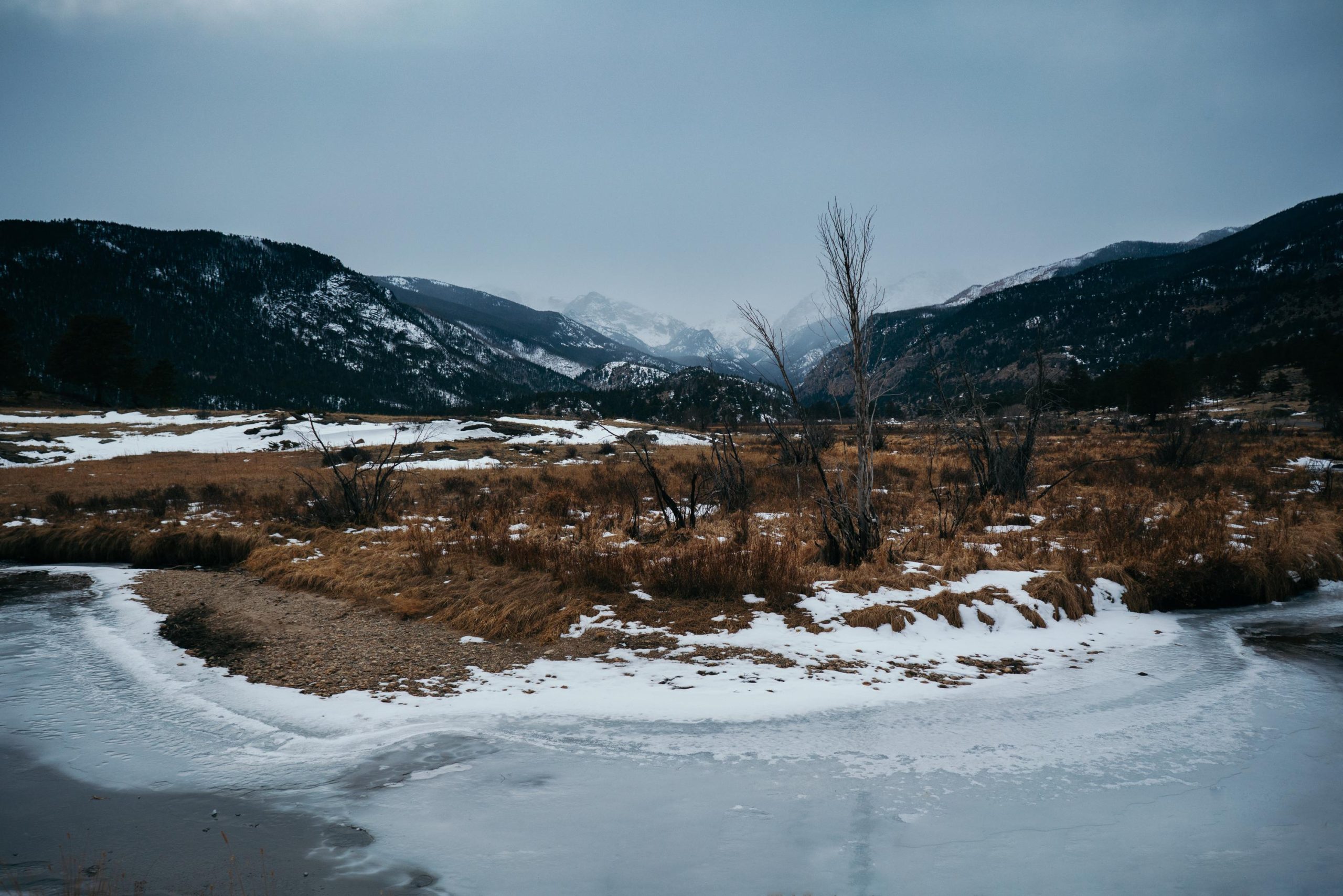
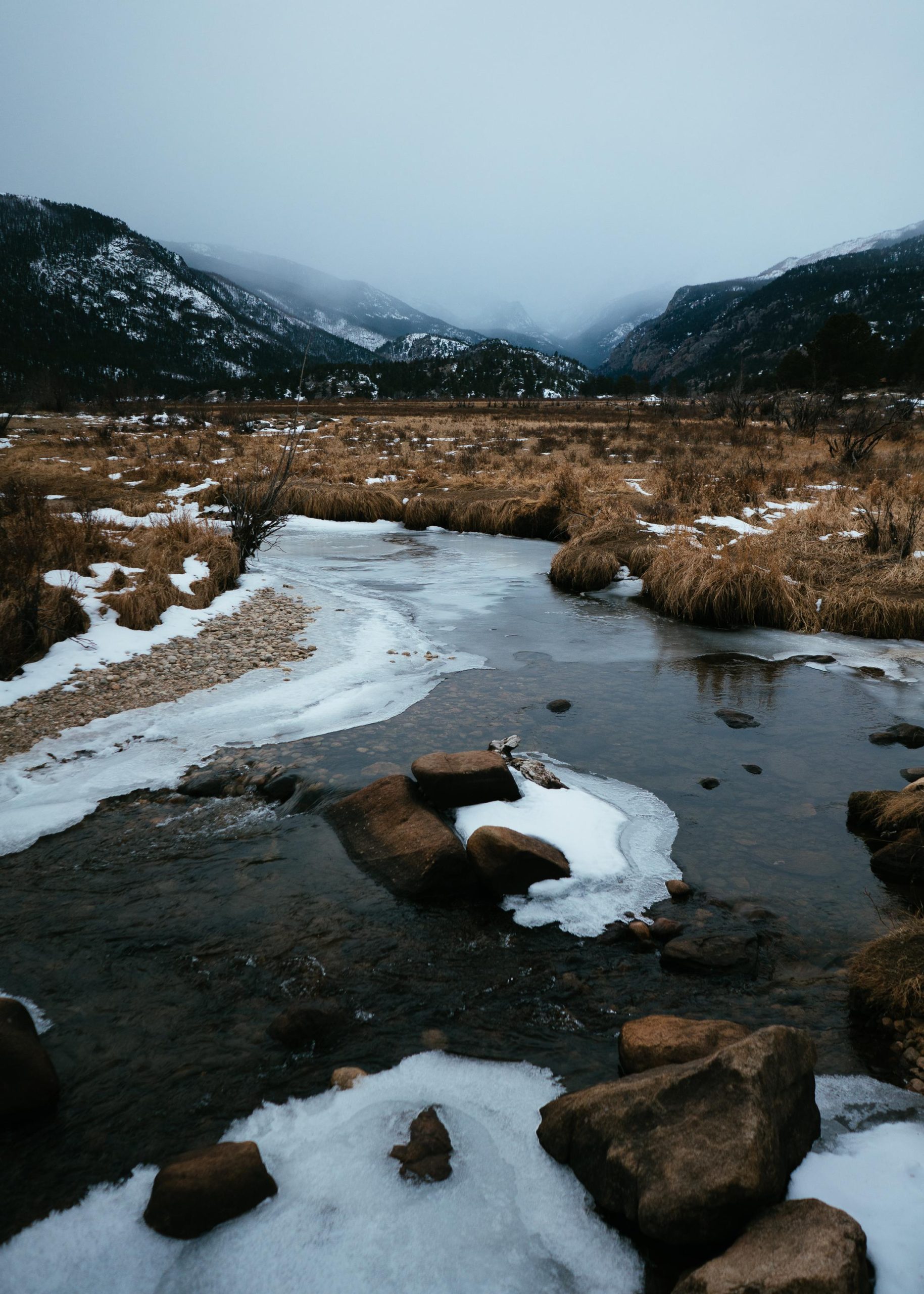
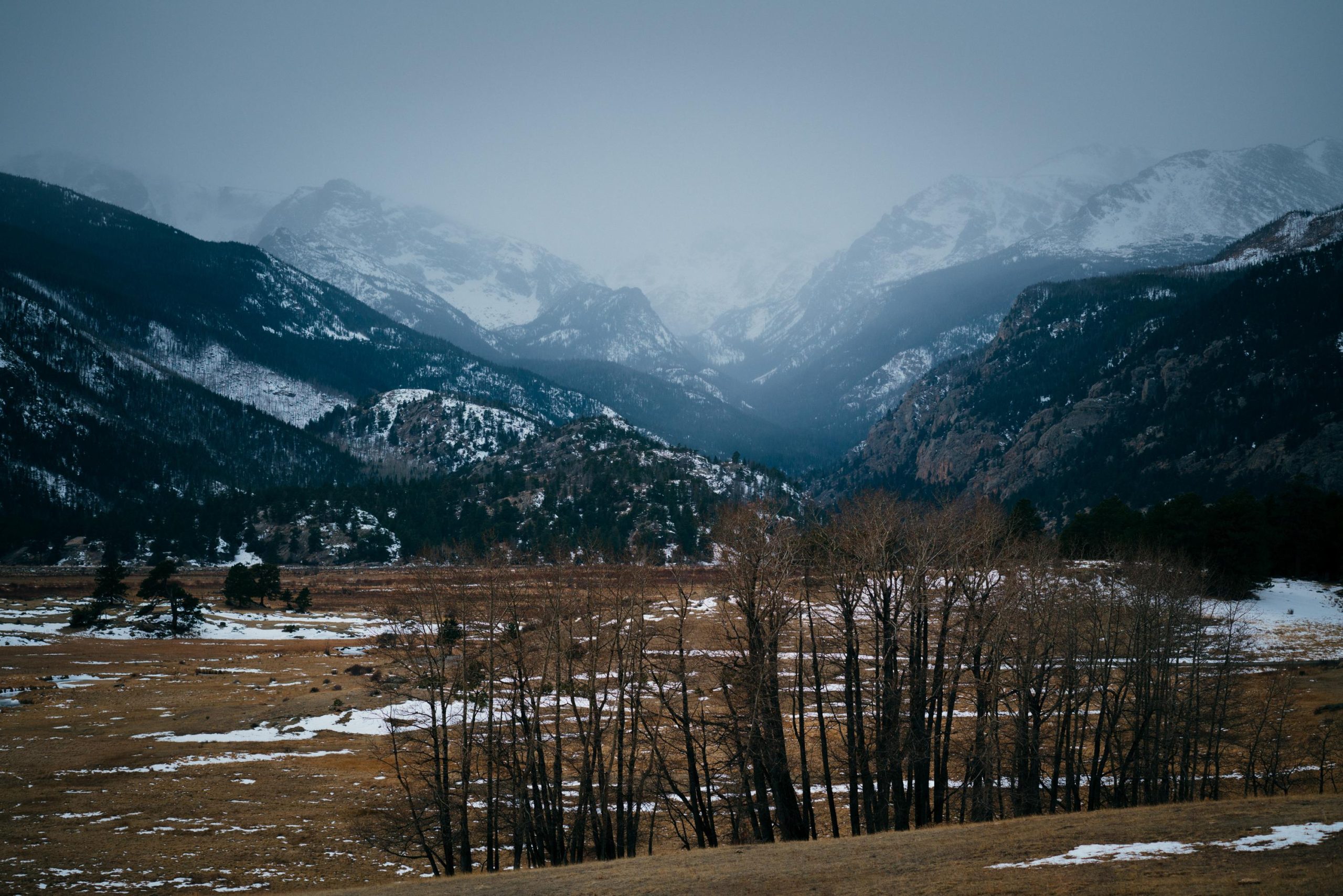
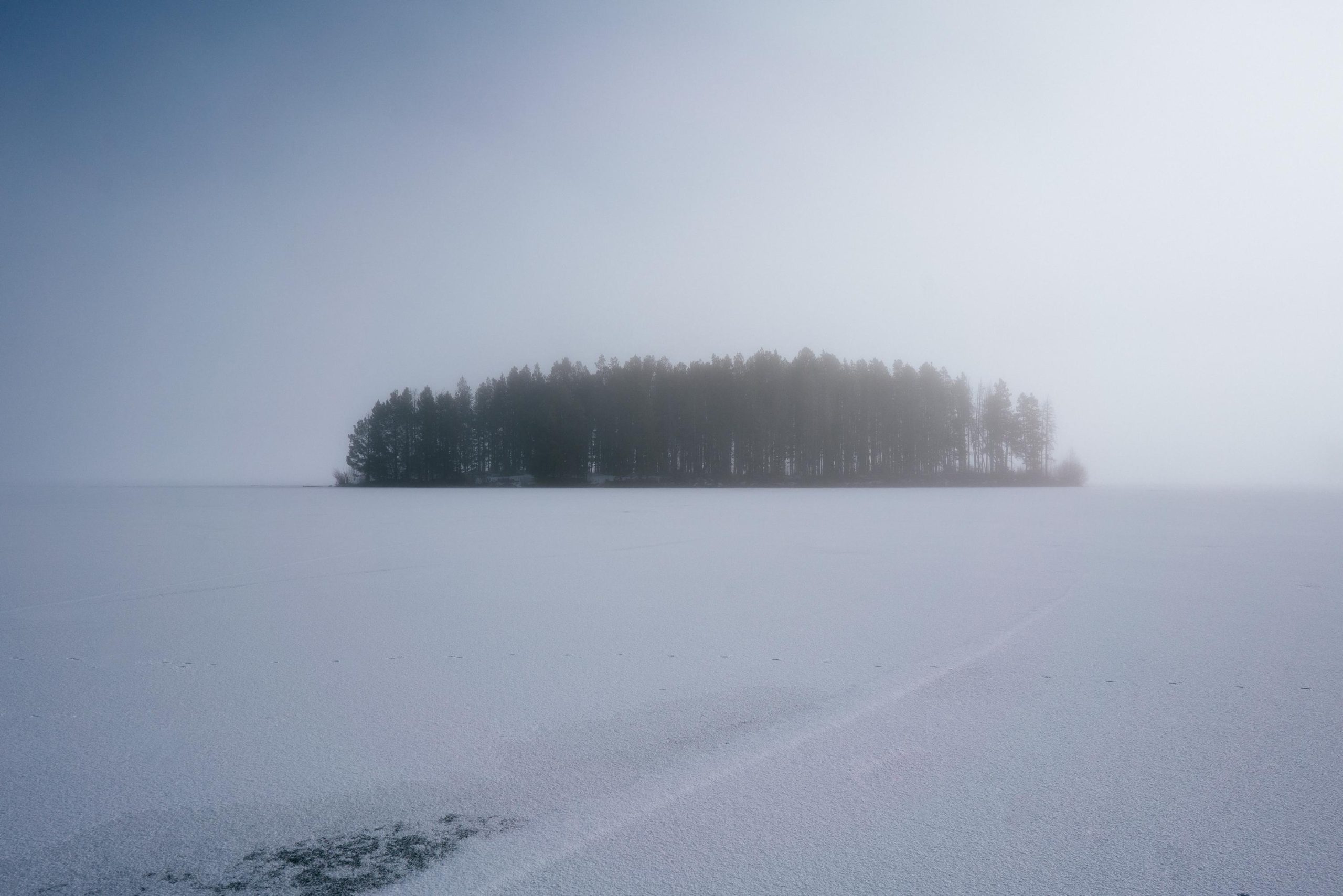
Plains, Rocky Mountain NP, USA
After entering the park this was the first area to be reached, with the option to go either in direction of Grand Lake or climb up the mountain to the lakes. I liked the colours, the yellow of the grass and the blues of sky and ice. I wish there were some animals but they must’ve migrated to lower elevations already.
I had to do a lengthy drive around the range, drive south quite a bit and then back up north to make up for the closed pass right in front of me. I was tired of crossing mountain passes, or tired of going down them, I tried to avoid them as well as I could, but they stayed with me all the way to California. The Rockies reached deep into the United States from Canada and California even had its own range, the Sierra Nevada.
This day turned out to be especially hectic as I had to get over 3 or 4 3000m high passes. I didn’t expect it but the roads were rather small and there wasn’t so much traffic, I was able to keep my automatic gear in 2 and do a lot of the breaking with the engine. The town on the other side was called Estes Park, it was a bit bigger and not as cute as Grand lake, I liked the resorty names the gave to these towns. I rolled in and the first thing I got was a nice burger to treat myself for dealing with all these big drops, followed by checking into the hotel I had booked on the way. Back to basics, I had gotten used to American cheap motels by now, this one turned out to be quite a big complex with another great (but not as good as in Moab) all you can eat breakfast.
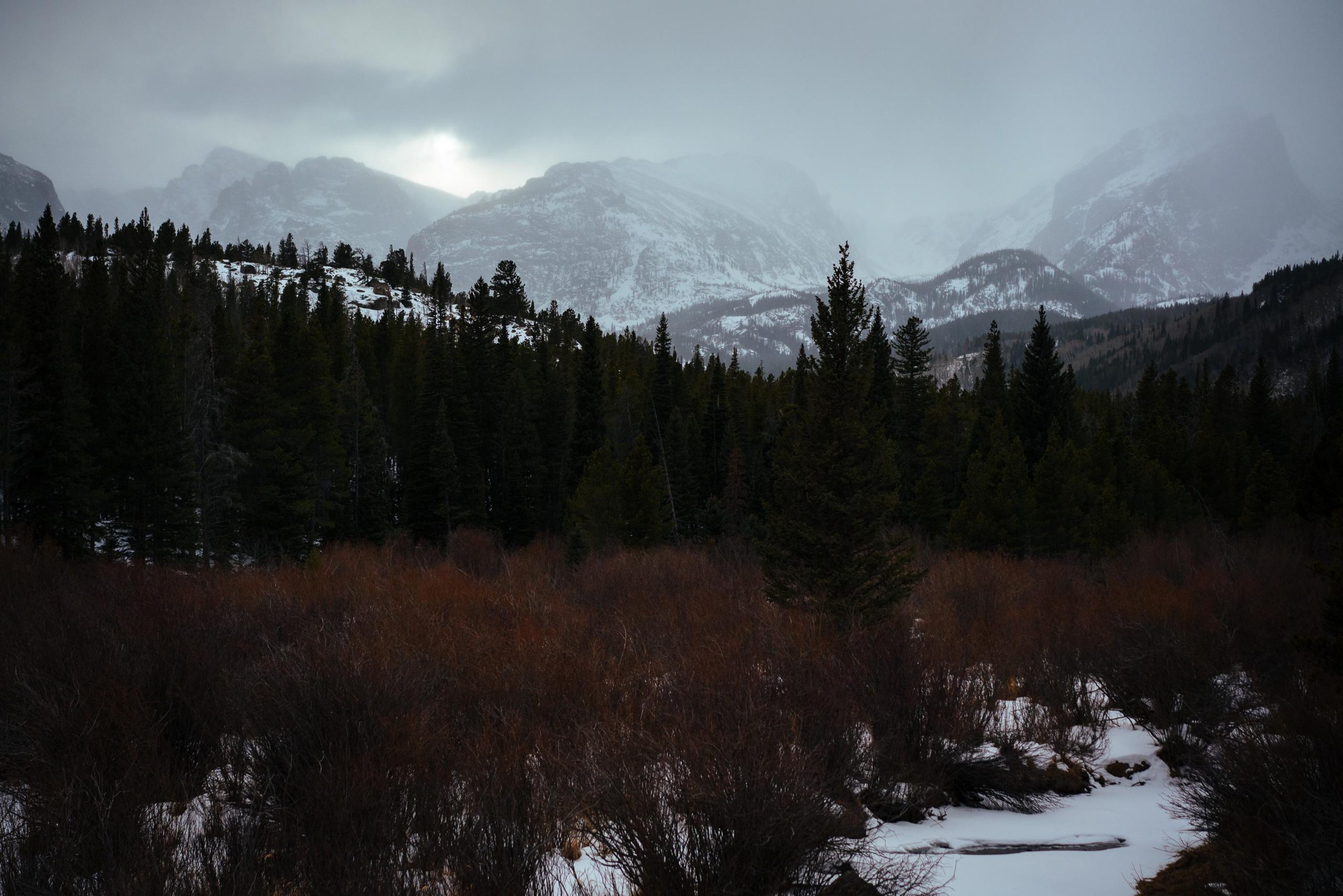
This side of the park wasn’t as closed as the area around grand lake yet, everything was still accessible, just the road crossing to the other side of the park had closed early. I stayed for a couple of days and did most of the short hikes and drove to all the viewpoints. The main activity here was to drive the winding road that led to the mountains to the end and then take a hike to one of the lakes. The lakes were all covered in thick ice, basically just a big snowfield so there wasn’t that much to see. There was news of a heavy winter storm supposedly coming in within the next couple of days. I got caught in the first bit of it on my last morning. I went to Dream lake for sunrise and the closer I got to the lake the more stormy and snowy it got. Once I made it to the lake the wind and snowfall were so strong it was a bit funny and scary as well having the hike back in mind. Unluckily I broke my jackets zipper, it was slightly broken before but now I couldn’t close the jacket in one of the heftiest storms at 3000m I’ve ever been in any more. It killed the vibes a bit and I left the lake earlier than I had anticipated. I even went to visit a TNF shop in Boulder to see what can be done and it turned out apparently nothing (at least quickly). Even with the proclaimed lifetime warranty it would have taken them 6 weeks to fix it, how is that going to help any explorer? From this point on the jacket turned into a hoodie held together from the inside with Gaffa tape. At some point I added a big stripe on the outside for a more solid feel as well, but to stay fashionable and not stand out even more in the crowds of the very well dressed amateur mountaineers I left it. With my jacket broken and the crazy winter storm experience I was cured of the cold.
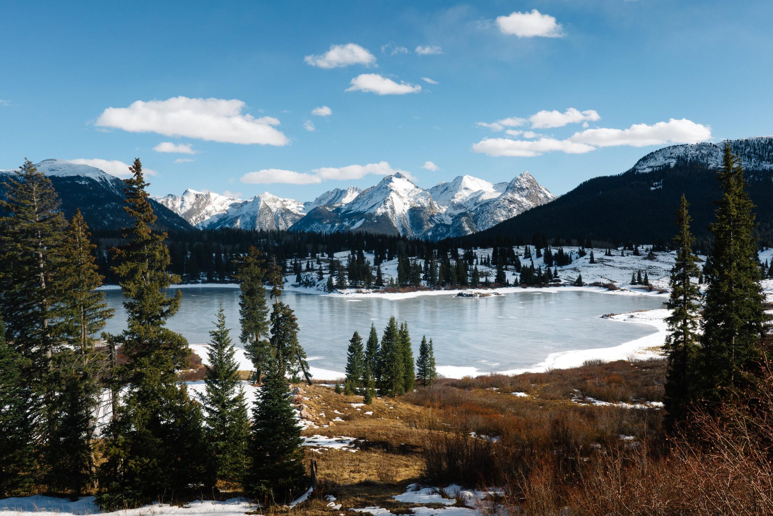
Mountain lake, Colorado, USA
This was taken on my way to the Rocky mountain NP. Crossing one of the many passes I came along this picturesque lake, I can’t remember what it was called but I found it very pretty. Some people were ice skating on the frozen surface, which was awesome as well.
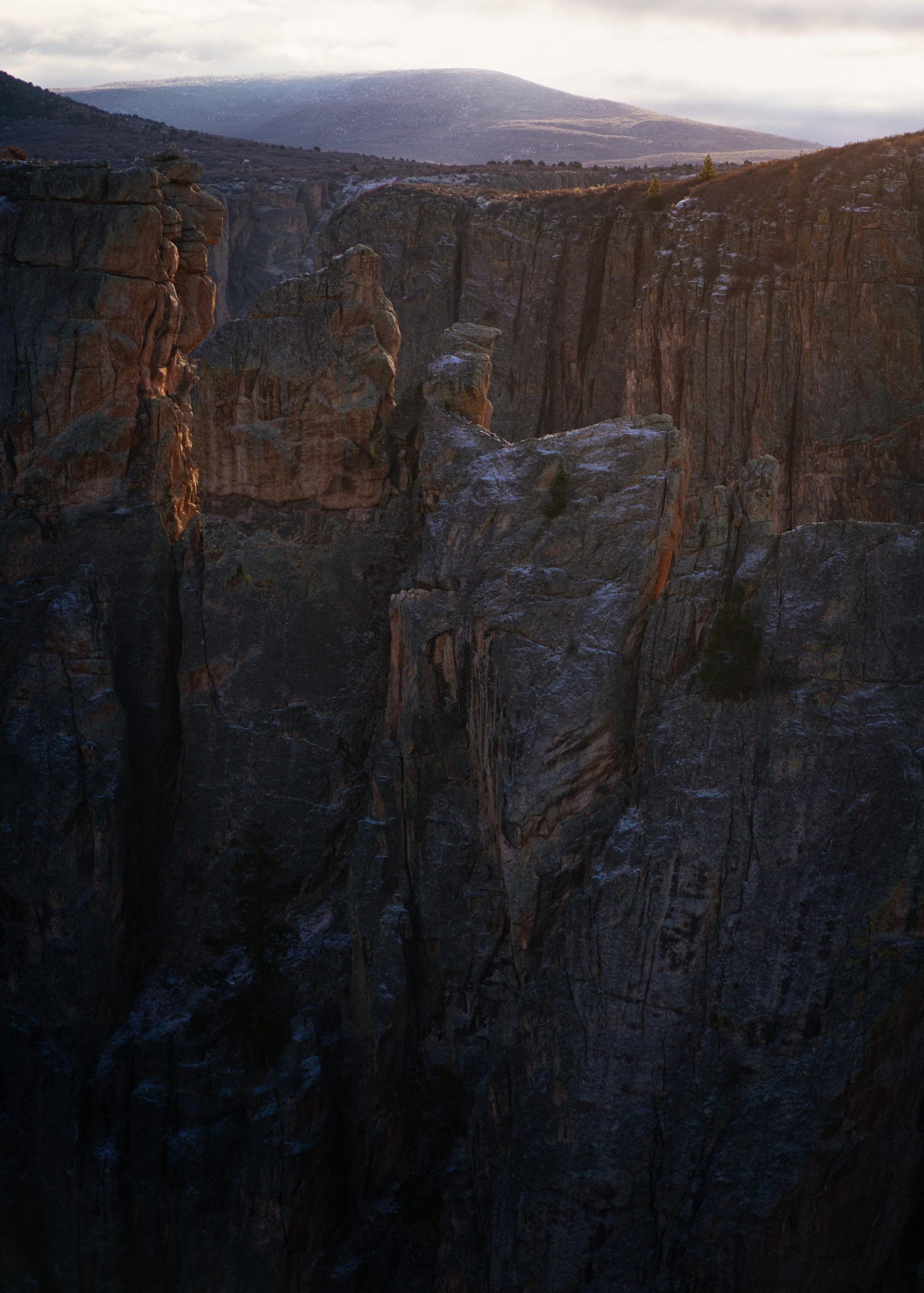
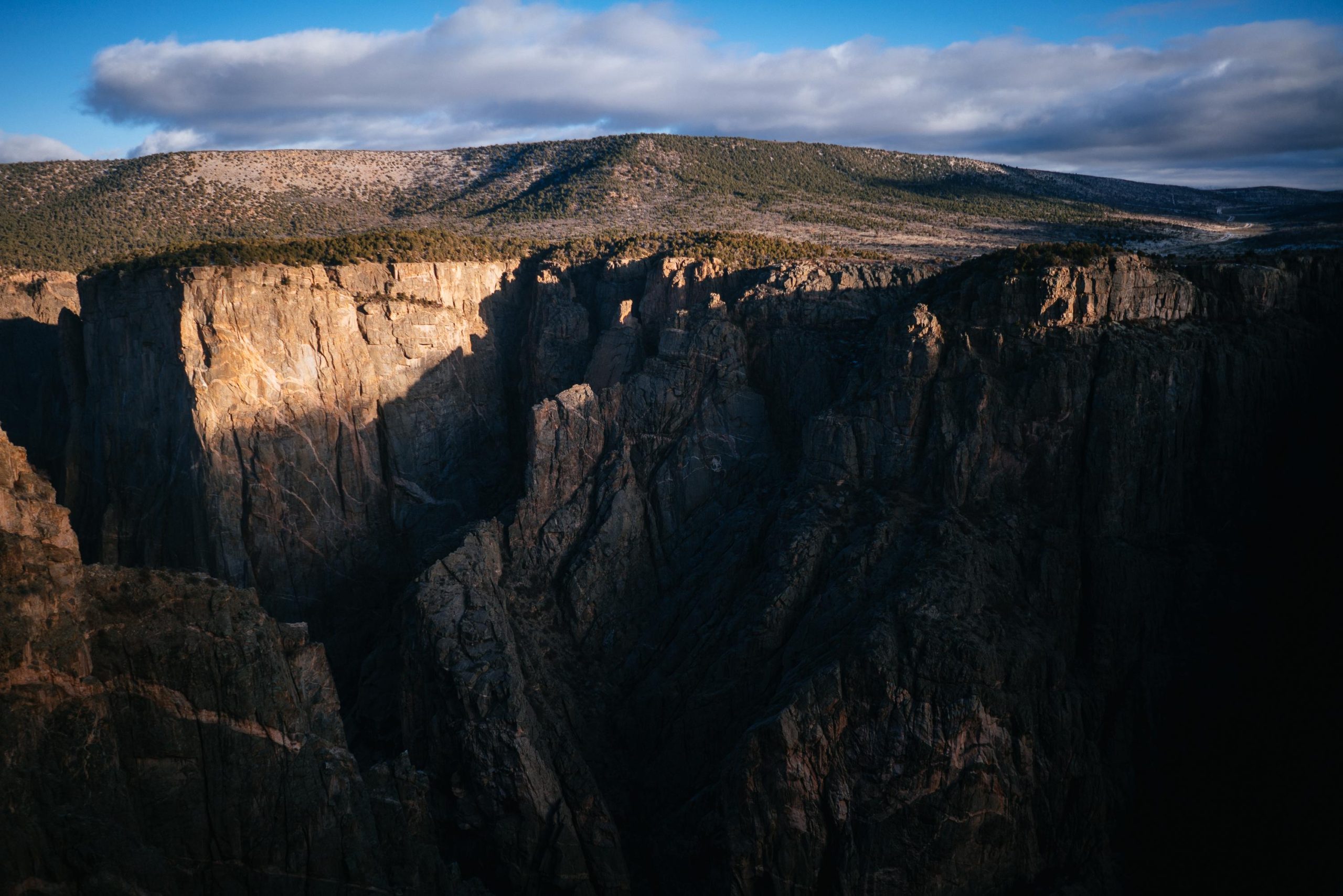
The Great Canyon of the Gunison
is an American national park located in western Colorado and managed by the National Park Service. There are two primary entrances to the park: the south rim entrance is located 15 miles (24 km) east of Montrose, while the north rim entrance is 11 miles (18 km) south of Crawford and is closed in the winter. The park contains 12 miles (19 km) of the 48-mile (77 km) long Black Canyon of the Gunnison River.
The national park itself contains the deepest and most dramatic section of the canyon, but the canyon continues upstream into Curecanti National Recreation Area and downstream into Gunnison Gorge National Conservation Area. The canyon’s name owes itself to the fact that parts of the gorge only receive 33 minutes of sunlight a day, according to Images of America: The Black Canyon of the Gunnison. In the book, author Duane Vandenbusche states, “Several canyons of the American West are longer and some are deeper, but none combines the depth, sheerness, narrowness, darkness, and dread of the Black Canyon.”
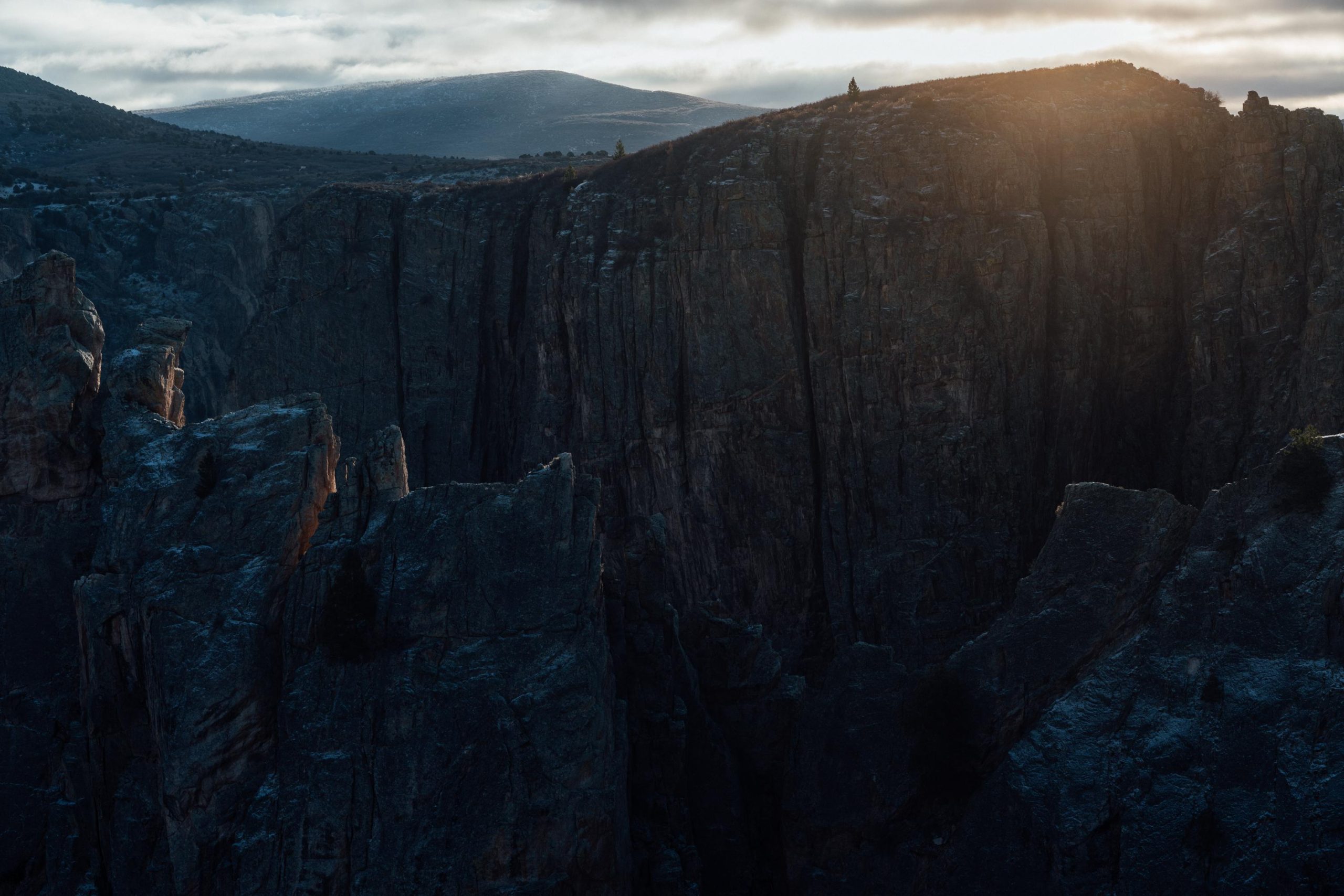
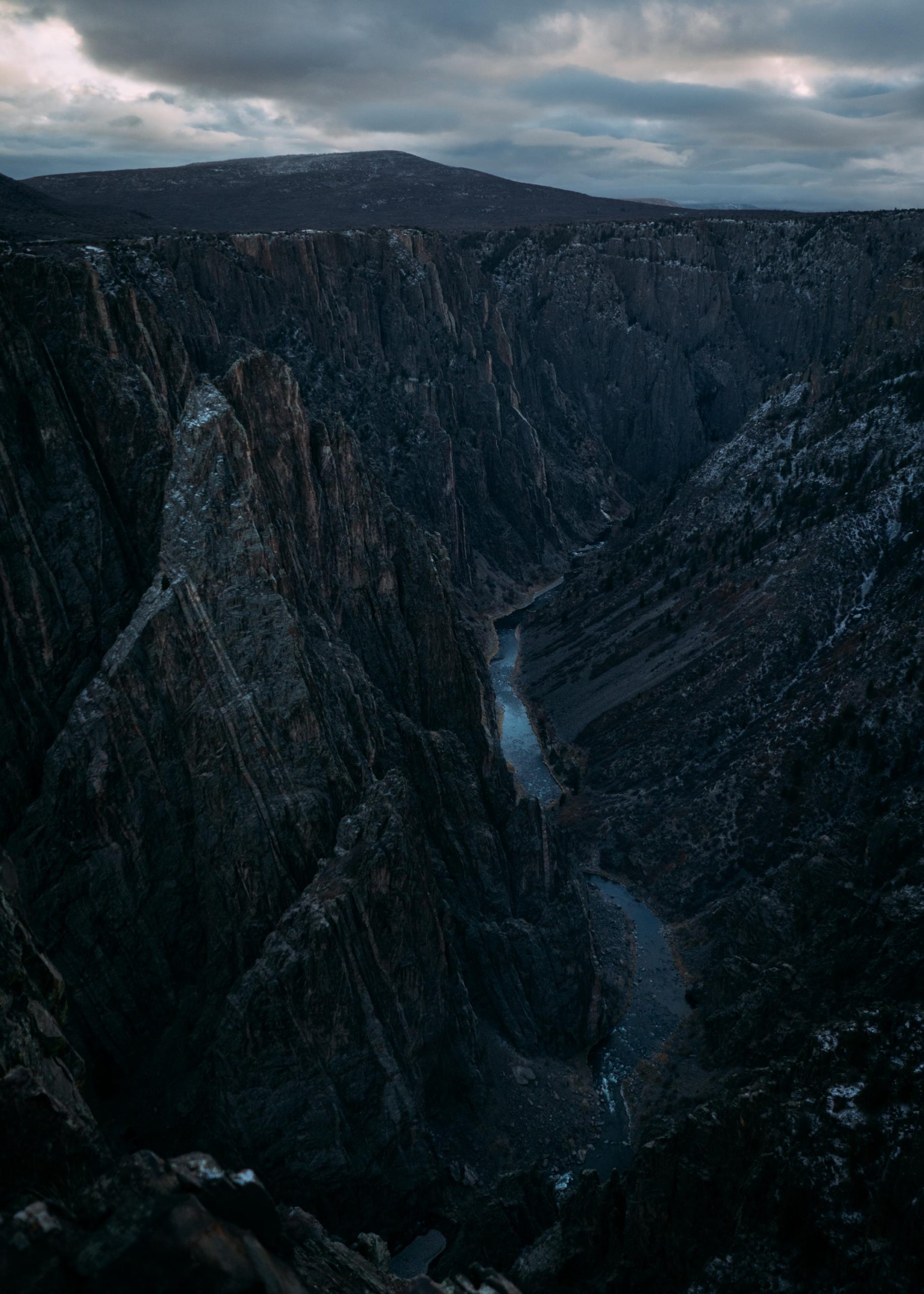
Sunrise, Black Canyon of the Gunnison, USA
Another early morning mission, this photo was taken at the Black Canyon of the Gunnison just as the sun peaked above the rim of the canyon.
To complete the loop of the National parks I had made out for myself it was necessary to drive back up north again, the next bigger destination was the Rocky Mountain national park, back to the snowy mountains again, I wasn’t really feeling the snow but I had to follow the plan.
In retrospect my route turned out to be quite zig-zaggy mainly the reason I racked up those 28.000km in the end. I had driven from Zion Np south to the north Rim of the Grand Canyon, did a complete turn around and visited Bryce in the north, drove further north-west and passed through Capitol Reef, then drove even further north-west to see Arches and Canyonlands which were close together. From there back down south to visit Monument valley and back up north to see the Goosenecks state park and The Valley of the gods. Then a big leap, again in the north west direction, to the Black Canyon of the Gunnison. Not the most optimal route, but I covered lots of ground and saw quite a bit of the country this way.
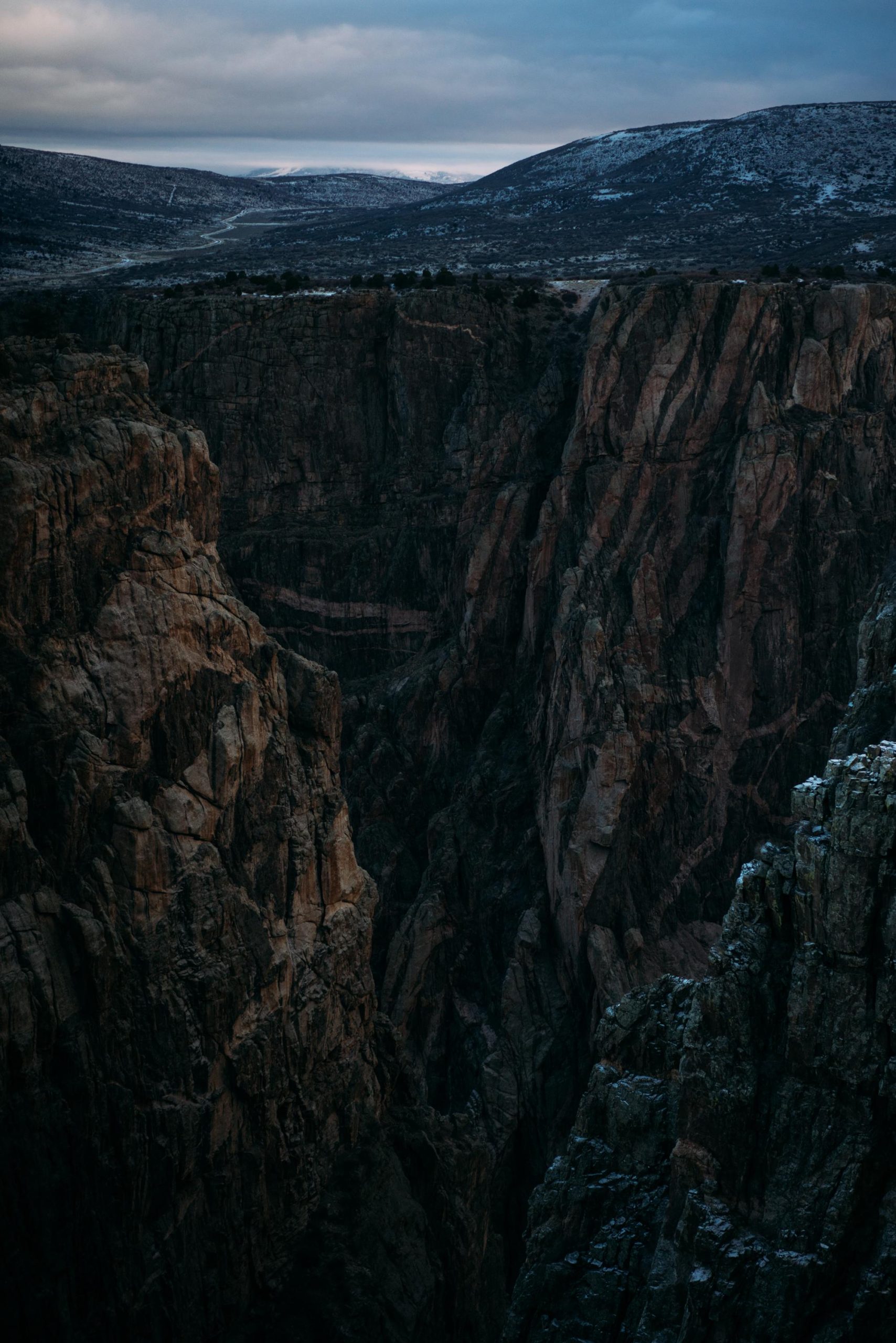
The Black Canyon of the Gunnison is one of the lesser known national parks in the states, but again it was worth visiting. I arrived in the dark so I couldn’t scope out any of the good locations, but the iOverlander app showed a sleeping spot right outside the park in a little forest of low trees with very crooked branches. I was able to get to the park quickly in the morning. So I climbed up the steep road that led to the ridge of the canyon and the sleeping spot was pretty much just outside the park next to a steep falloff. I came in the dark and somehow manoeuvred myself into quite a tricky situation, it was easy to get in but hard to get out of. I had to turn the vehicle around to leave or it would’ve been a quite a long way to drive backwards. I left it for the morning. The spot was very tight, it had little trees everywhere and a steep falloff on one of its sides, it had also snowed at night giving me a taste for the Rocky mountain park. So the turnaround was even more tricky and not being able to see the path I nearly slipped off the edge a little bit, but some of the bushes on the ground saved me from sliding down too fast and provided some sort of traction. This must’ve been around 5-6am, I was still very tired and I hadn’t even had coffee.
I stayed for sunrise, the park was easily accessible by car and I stopped for most of the viewpoints. It had snowed over night but nothings too serious maybe 2-3cm of snow had fallen in some places. I lay first tracks on the road for a while which is always fun, it was icy and slippery at times. I followed the snowy road to the end, stopping at most of the viewpoints on the way, mostly short walks that led out to the canyon.
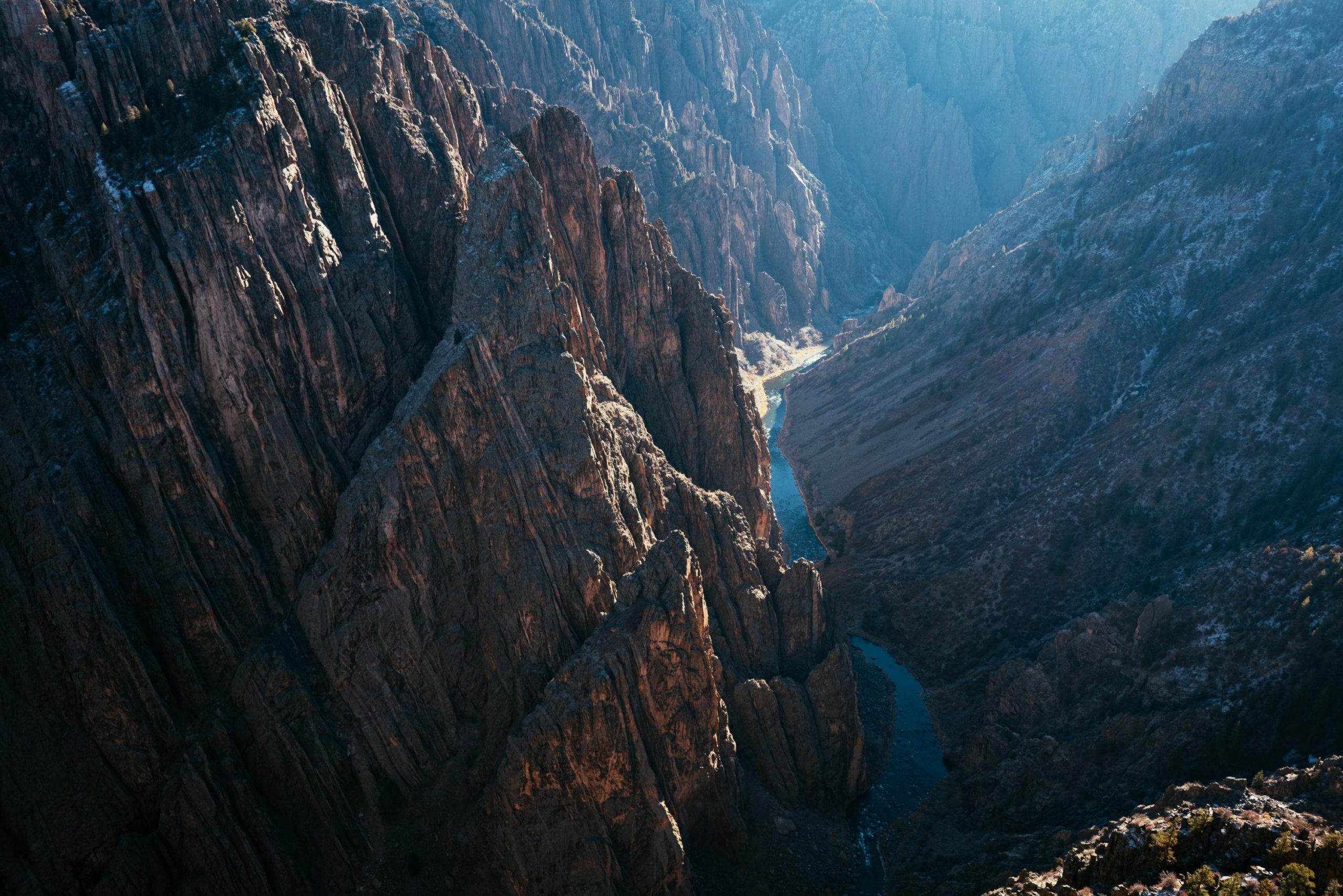
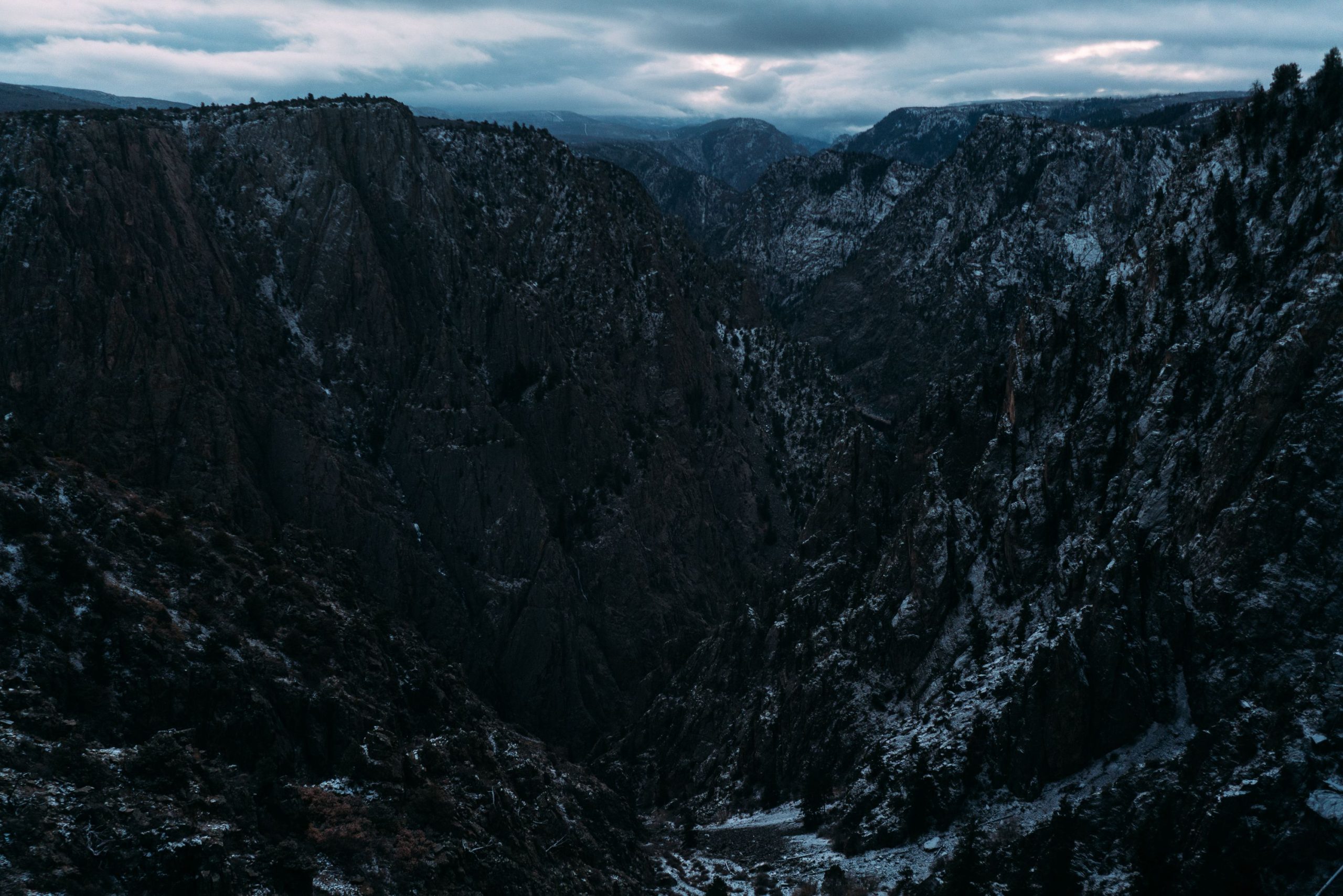
The Canyon, Black Canyon of the Gunnison, USA
Here it is, the river that carved the Black Canyon of the Gunnison over thousands of years. This picture was taken on my way back on the road of the viewpoints. In the gallery above is a picture taken from the same viewpoint on my way in, with the sun hidden behind clouds or mountains and here the “black” in the title of the national park makes more sense.
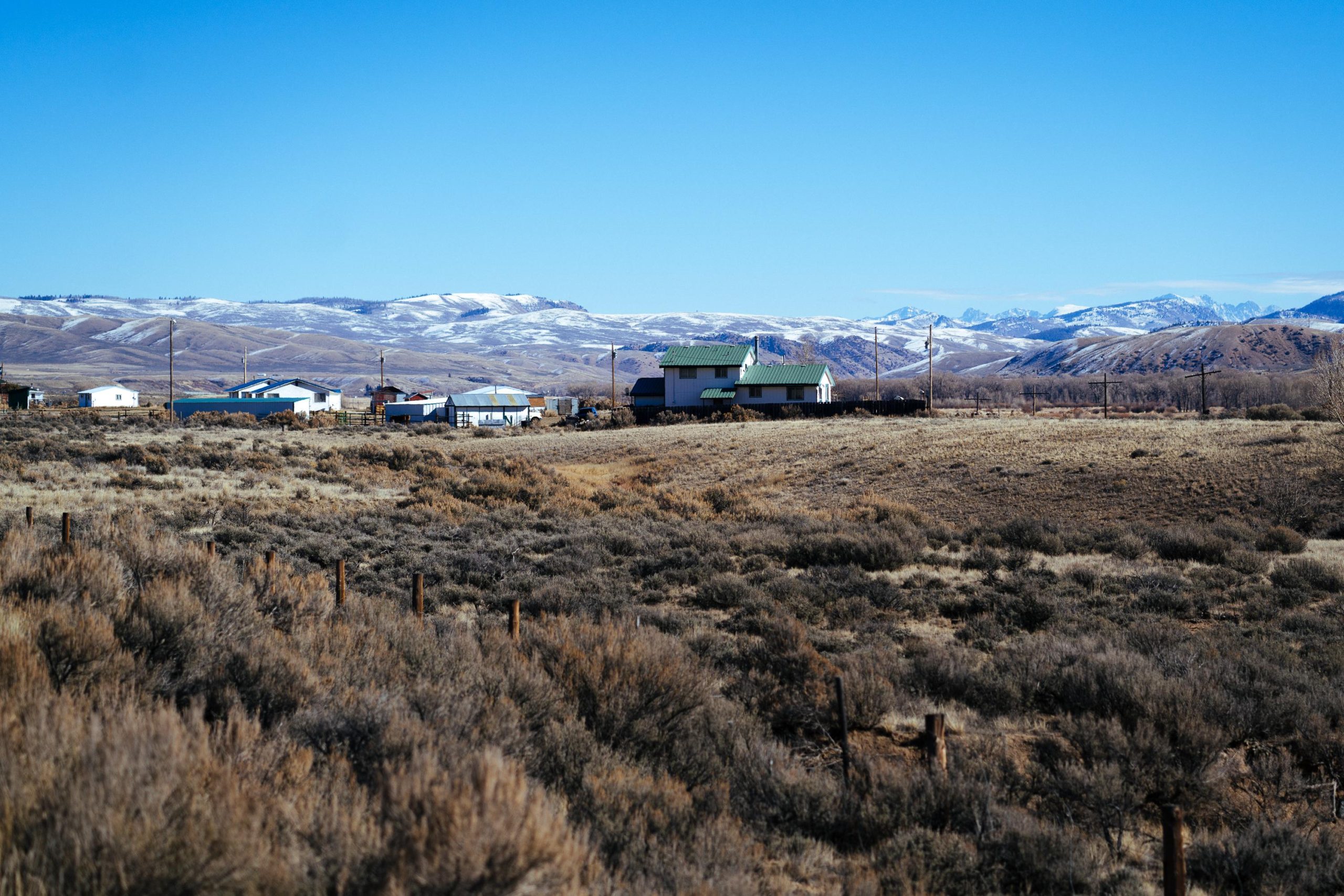
Out there, Colorado, USA
Driving through America… This must’ve been at around km 18.000, somewhere in the middle of Colorado. Coming from Germany, which is quite dense in some parts and isn’t that enormous in general, driving for hours without being in touch with civilization was a great experience.