Great Sand Dunes
is an American national park that conserves an area of large sand dunes up to 750 feet (230 m) tall on the eastern edge of the San Luis Valley, and an adjacent national preserve in the Sangre de Cristo Range, in south-central Colorado, United States. The park was originally designated Great Sand Dunes National Monument on March 17, 1932, by President Herbert Hoover.
The original boundaries protected an area of 35,528 acres (55.5 sq mi; 143.8 km2)] A boundary change and redesignation as a national park and preserve was authorized on November 22, 2000, and then established on September 24, 2004.The park encompasses 107,342 acres (167.7 sq mi; 434.4 km2) while the preserve protects an additional 41,686 acres (65.1 sq mi; 168.7 km2) for a total of 149,028 acres (232.9 sq mi; 603.1 km2). The recreational visitor total was 527,546 in 2019.
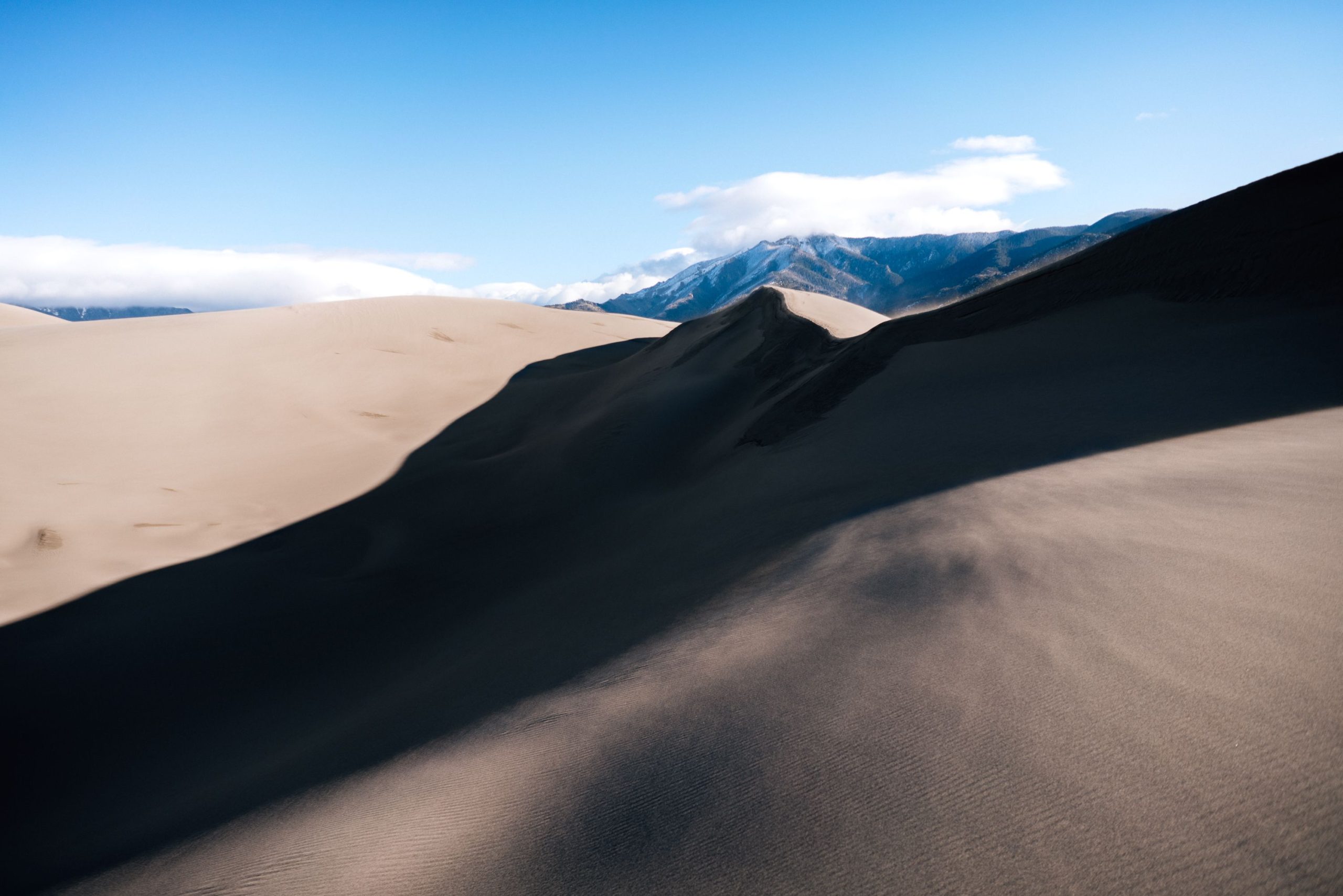
The park contains the tallest sand dunes in North America. The dunes cover an area of about 30 sq mi (78 km2) and are estimated to contain over 1.2 cubic miles (5 billion cubic metres) of sand. Sediments from the surrounding mountains filled the valley over geologic time periods. After lakes within the valley receded, exposed sand was blown by the predominant southwest winds toward the Sangre de Cristos, eventually forming the dunefield over an estimated tens of thousands of years. The four primary components of the Great Sand Dunes system are the mountain watershed, the dunefield, the sand sheet, and the sabkha. Ecosystems within the mountain watershed include alpine tundra, subalpine forests, montane woodlands, and riparian zones.
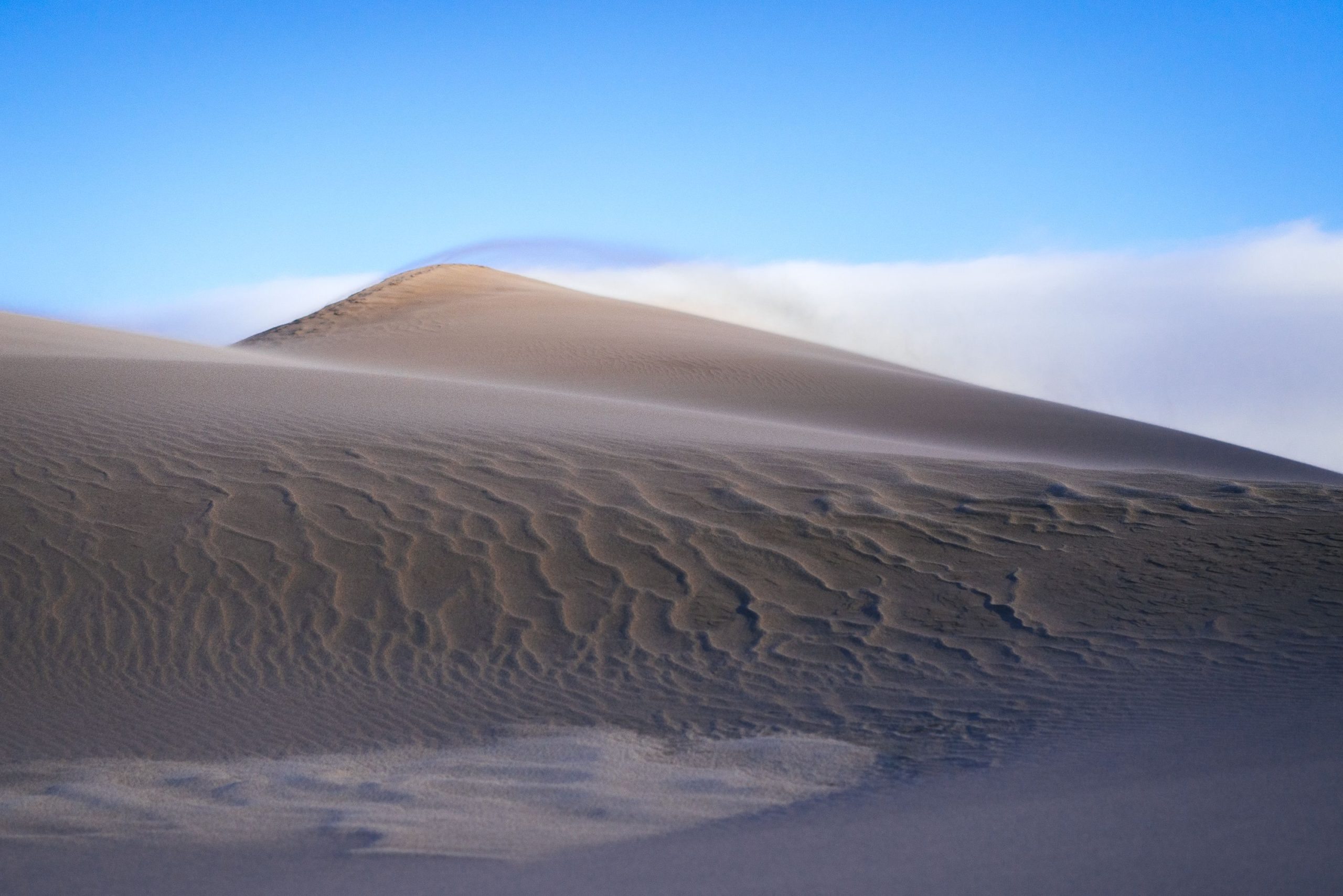
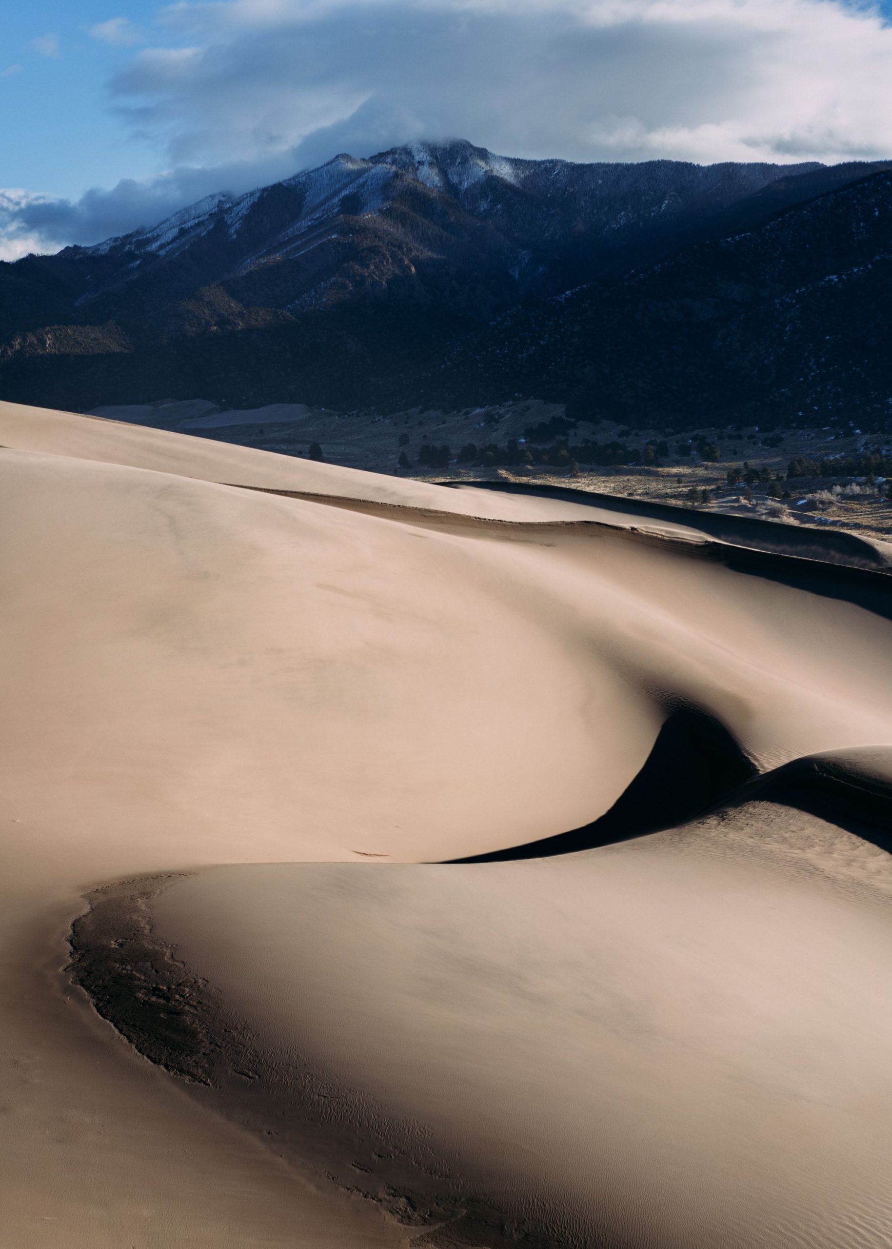
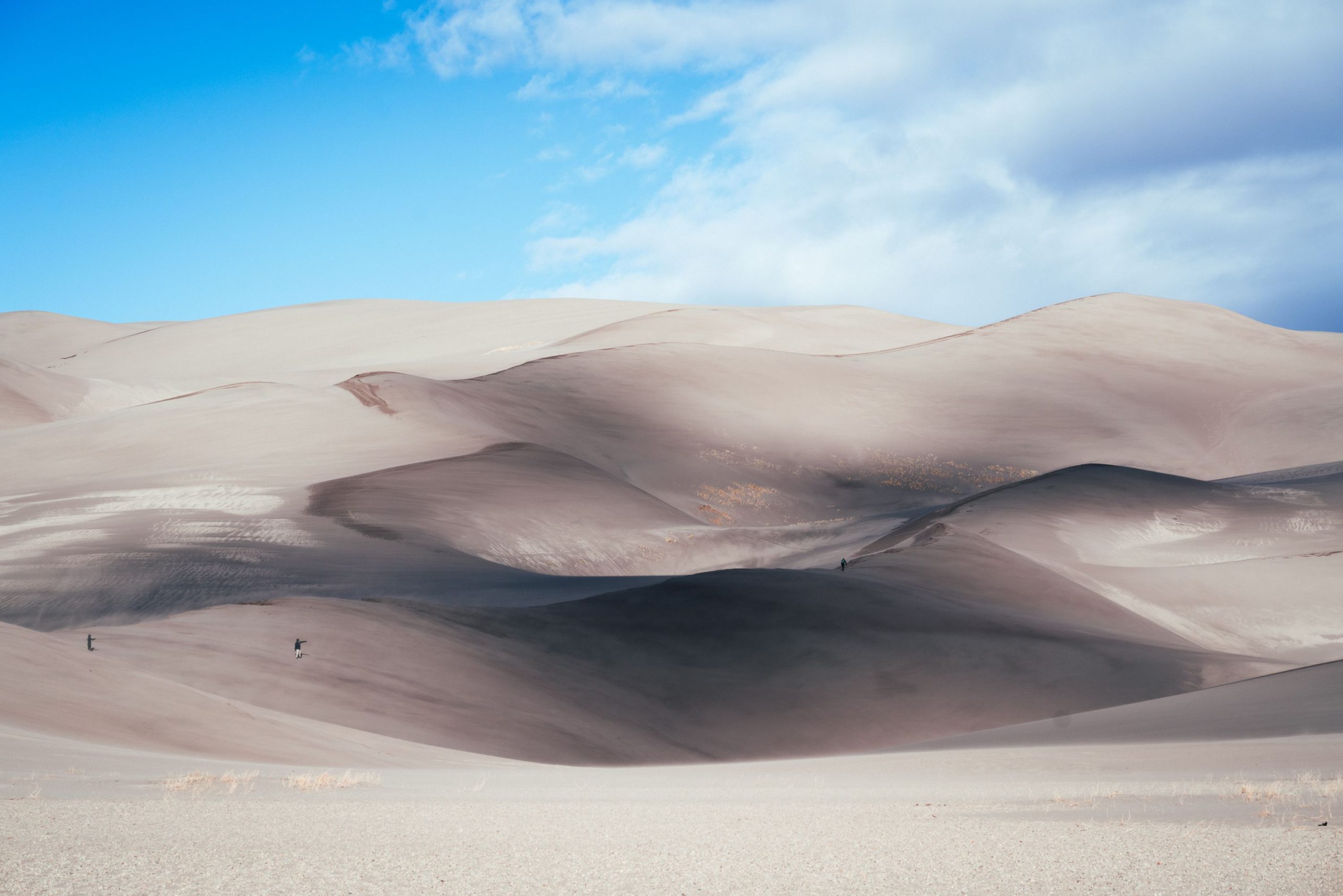
Dune, Great Sand Dunes NP, USA
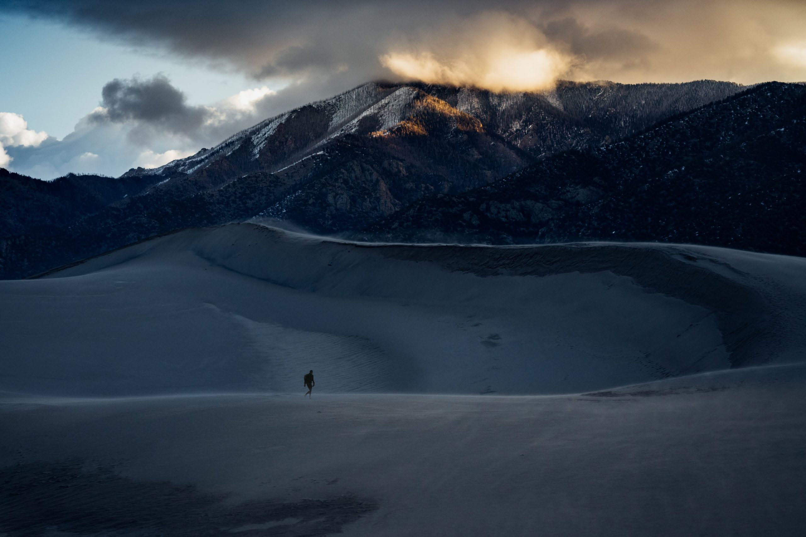
This was one of the first shots of the day, it must’ve been around 7am and I was mostly alone in the park, just this one guy made it in there as well. We made the best of trying to avoid ourselves and I am sure we’ve both used us to pose in each others photos unknowingly.
I had to flee the Rockies and Estes park because of an incoming winter storm. The news said it might be possible to get stuck up there and not be able to get out for a while.
I had been in the Rockies for long enough, so I gathered my things, took one of the supposedly last big drops of the trip and got onto the highway into the plains just next to the Rocky Mountain range. I drove south in direction of the sun, I passed Boulder, Denver and drove around 500km that day. It’s impressive to drive through the CBD of a big American town, the buildup, then all the skyscrapers and then back to the suburbs and smaller buildings. The highway led straight through town and traffic got quite dense, more attention was required to navigate the highway. I had been in the United States for one and a half months but managed to avoid the bigger cities, this was only my second metropolis on the USA side of the trip and I had no desire to enter it other than gas. I visited Bowlder to get my jacket fixed but failed miserably. The city was quite nice, it even had somewhat of a core with shopping streets and a bit of a theme park/mall vibe. This place was different from the untidy hillbilly towns out in the backcountry I had seen so far.
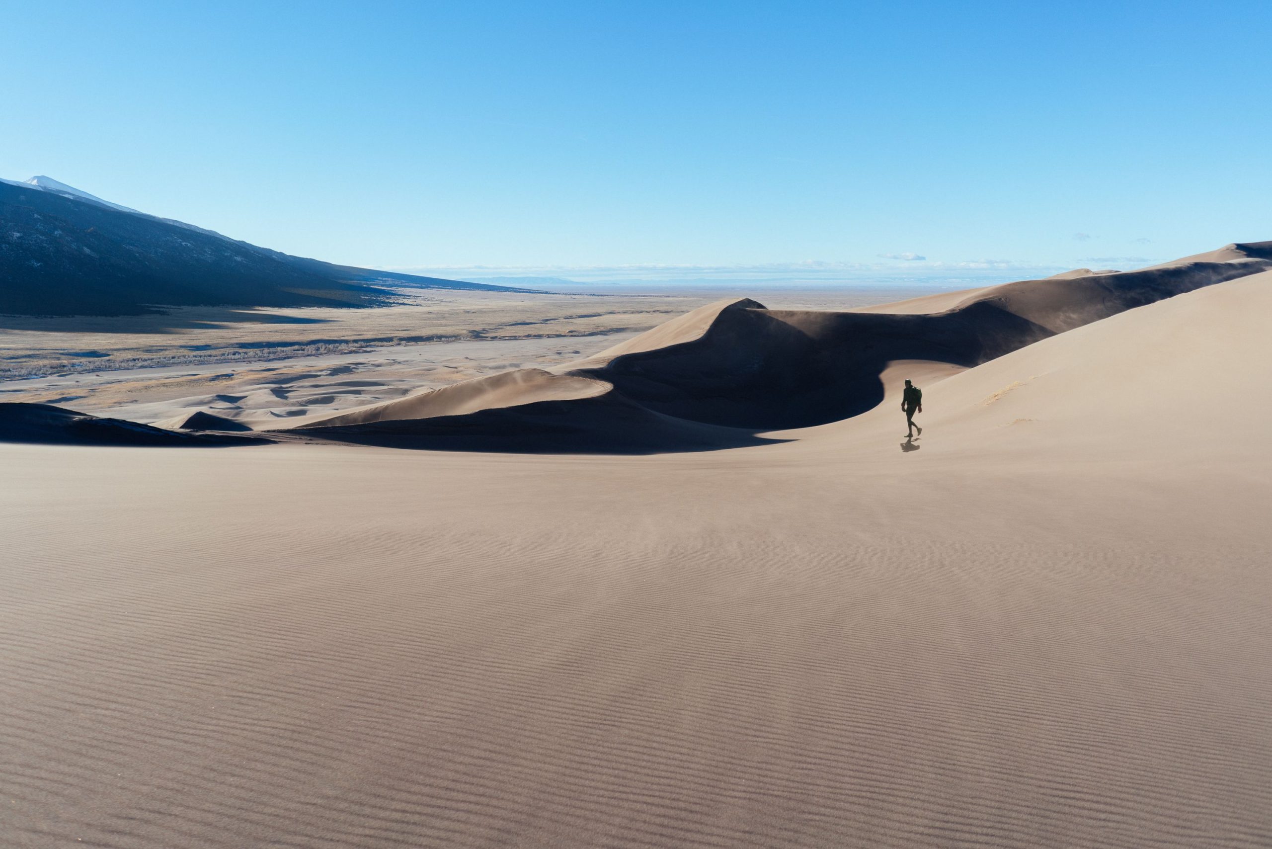
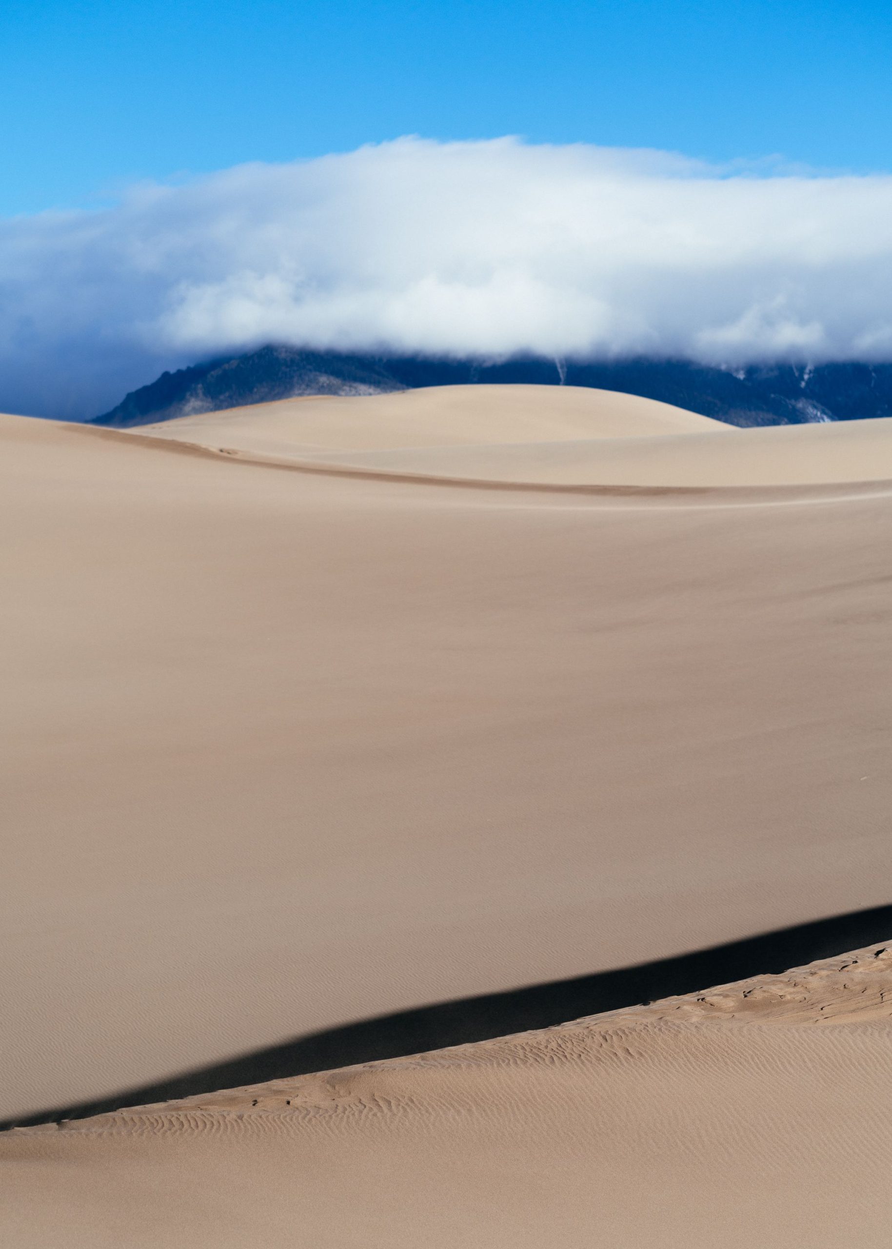
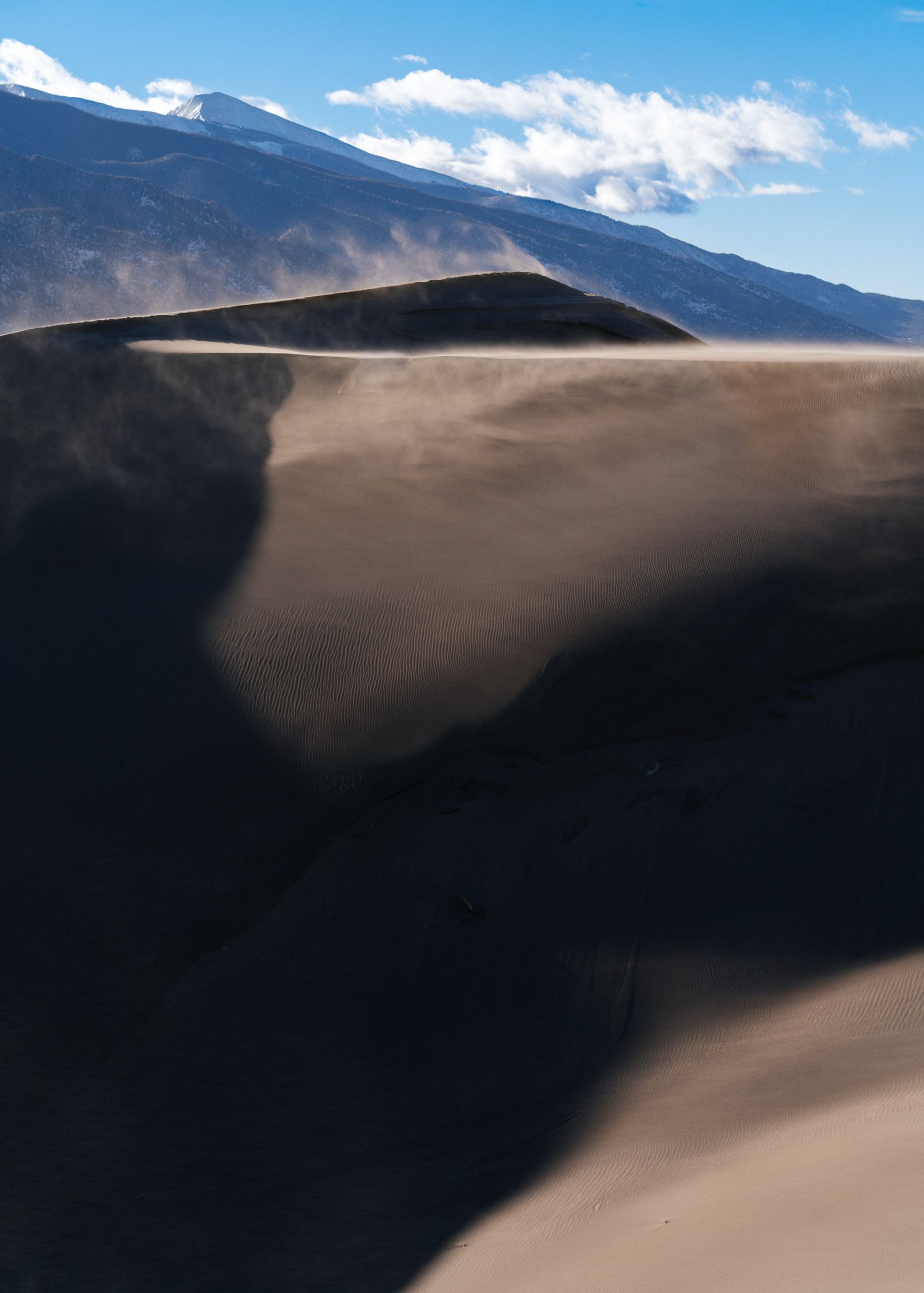
Another Dune, Great Sand Dunes NP, USA
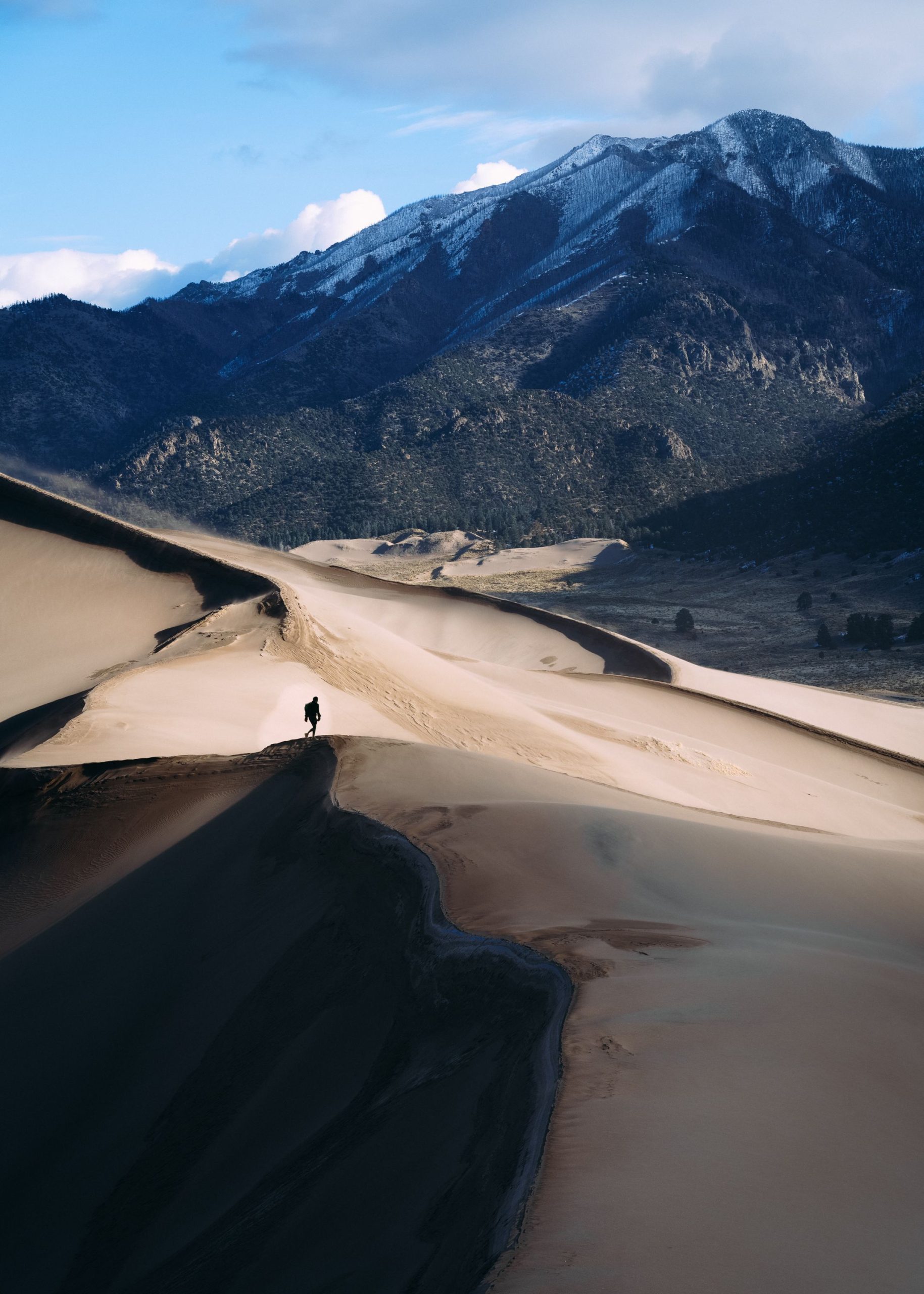
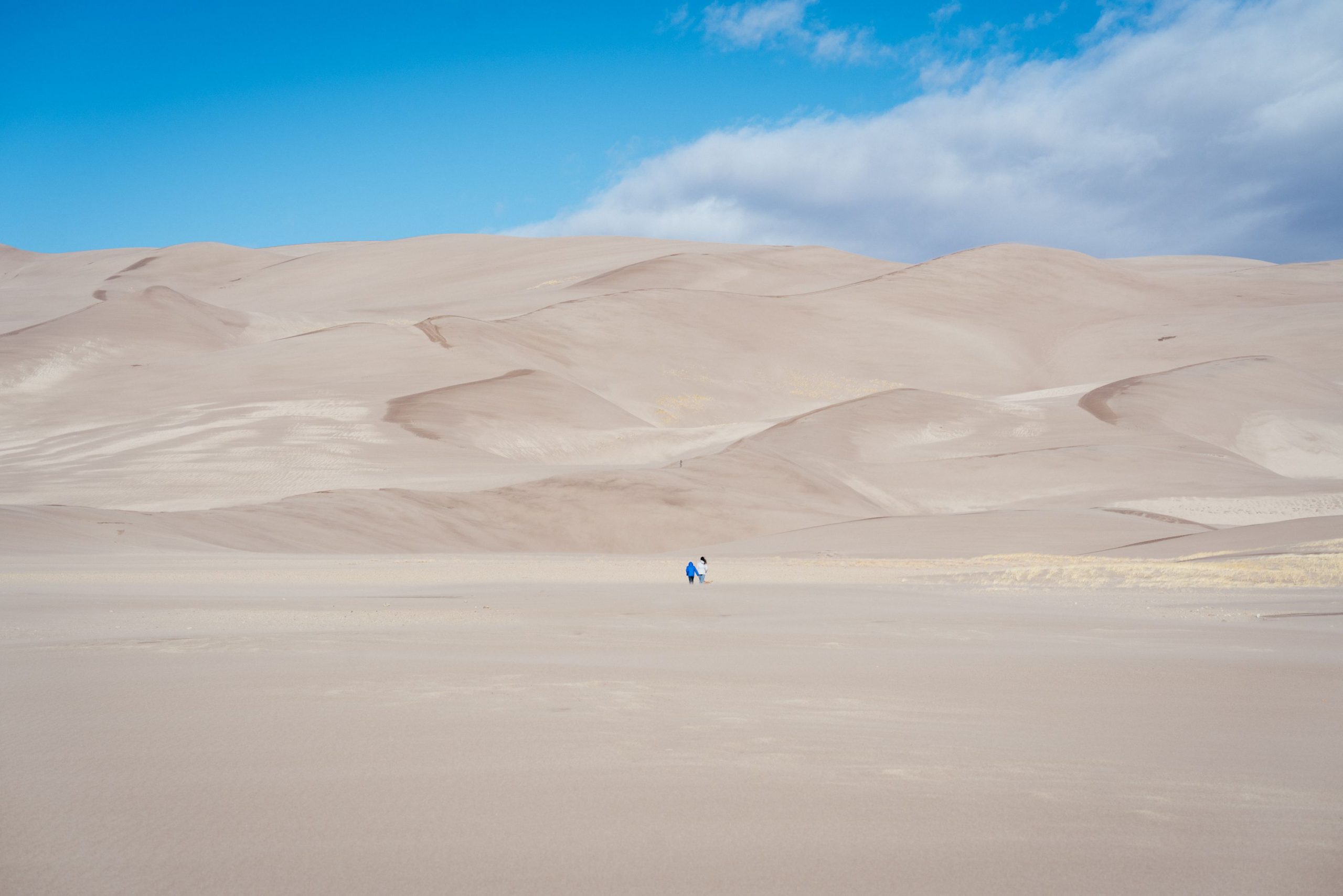
This was one of the last shots of the day, it must’ve been around 12am and I wasn’t alone in the park any more, it turned out to be hard to find shots without too many people in them. They mostly came from the direction of the parking lot, so I was going deeper into the dunes.
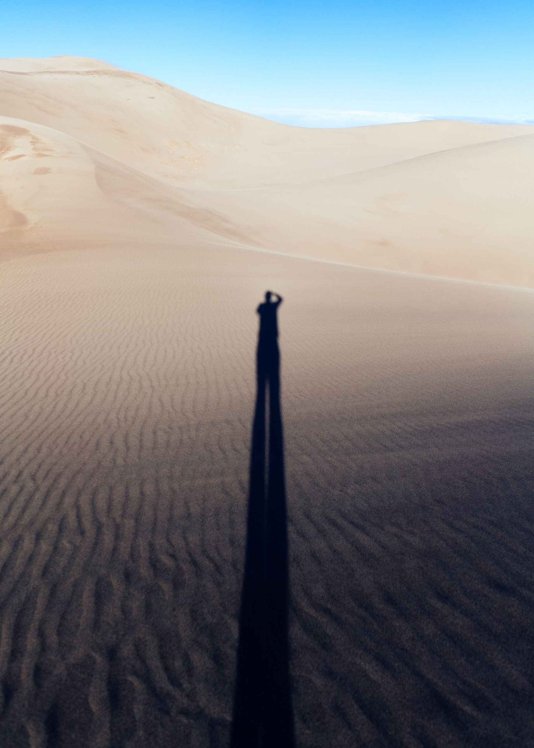
Mr. long legs, Rocky Mountain NP, USA
This was shot early on as well, using the low sun and the hillside of the dune to create even longer legs than I would’ve had on even ground.
I had to drive south for a while and then take a left turn to get back into the Rocky Mountain range and visit one more place in the cold, the Great Sand Dunes national park. I didn’t make it to the park that day, but drove straight to a spot to sleep, a field on the side of a hill a good bit away from the “highway”.
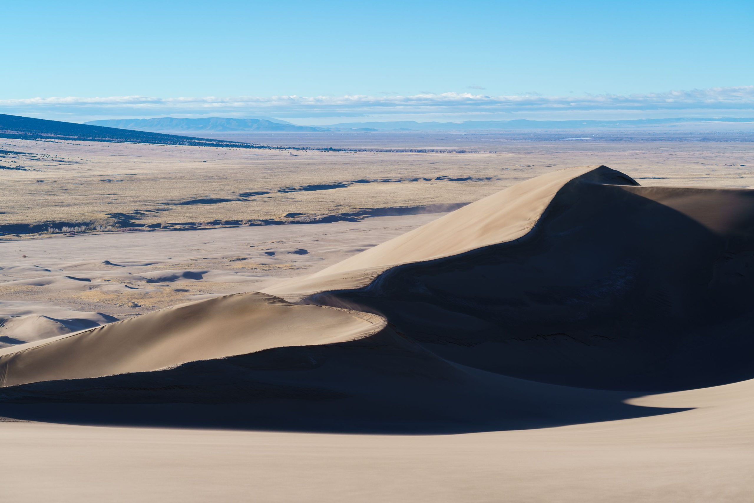
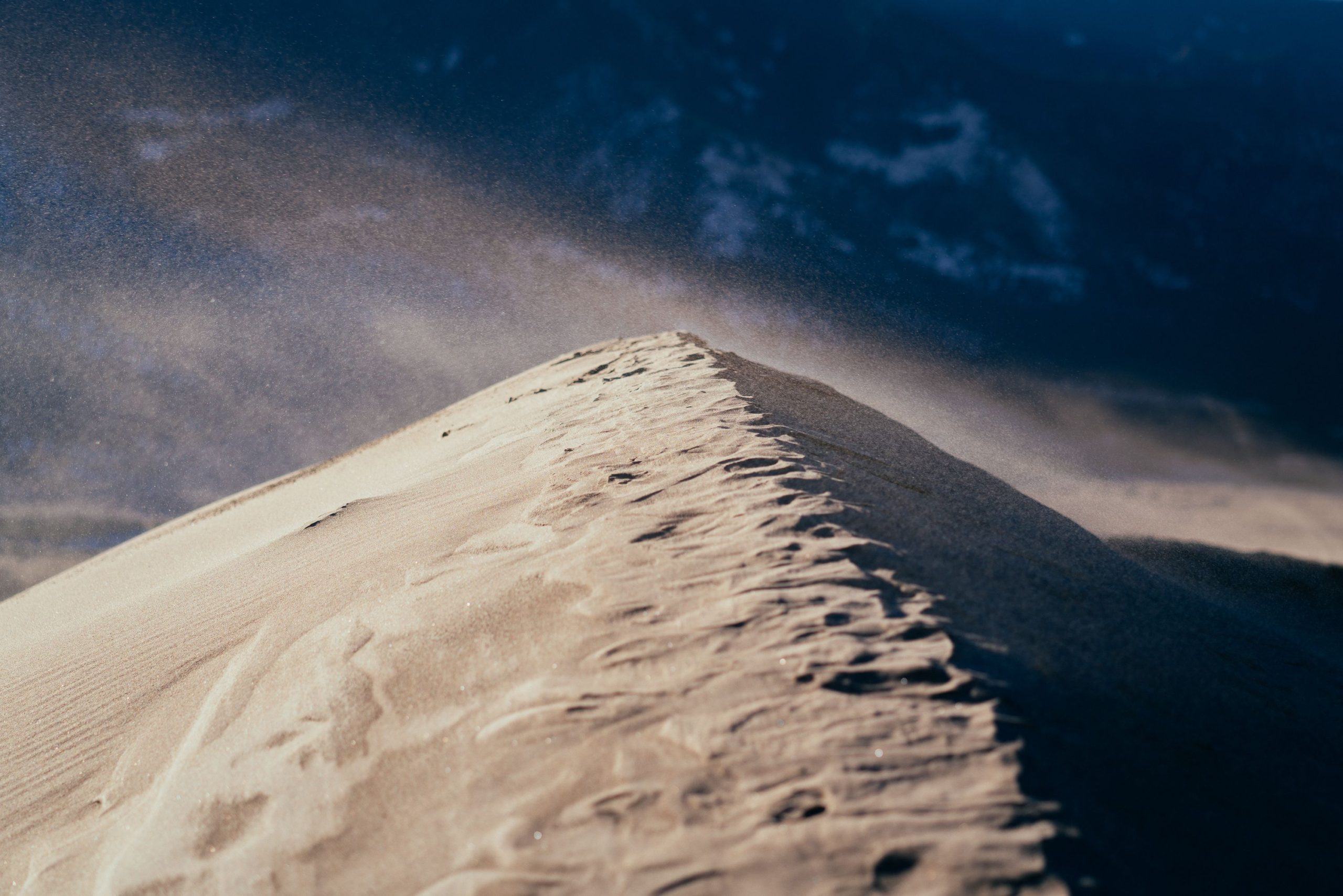
I bought some crisps and nuts at the gas station for dinner and prepared myself for another cold night. As it is with cold nights, you don’t sleep well and I was always happy to finally get up and running before sunrise at 5-6am, get the car ready, turn the heater on full blast and find coffee somewhere. I cruised the street that led to the park just at the right time for sunrise as it came up behind the mountain on my right side, good mood, probably even got some super early coffee at the same petrol station. The dunes turned out to be higher than expected, the park was located in a corner next to the Rocky Mountain range and it was possible to oversee most of it if on the highest sand dune. The mountains still covered most of the dunes with shade while I made my way into the sand. They looked high and impressive from the distance, but the closer I got the higher they seemed to become and once I started the ascent they looked gigantic, especially for dunes. It was a very windy day, the little sandcorn clouds on the ground were pretty wild they felt like 1000 little needles pinching. It was bearable but I had to cover myself, and the sand got everywhere. Changing the lenses of the camera was it risky. At times the whole ground was covered in a stormy cloud of tiny rocks and the sand would shoot off of the top of the dunes in my face sometimes as well. I did my sunrise walk around the dunes and once it had climbed high enough for the good light to vanish I decided it was time to leave and go back to the car, de-sand myself eat the last food I could find in the car and get back to driving further south.
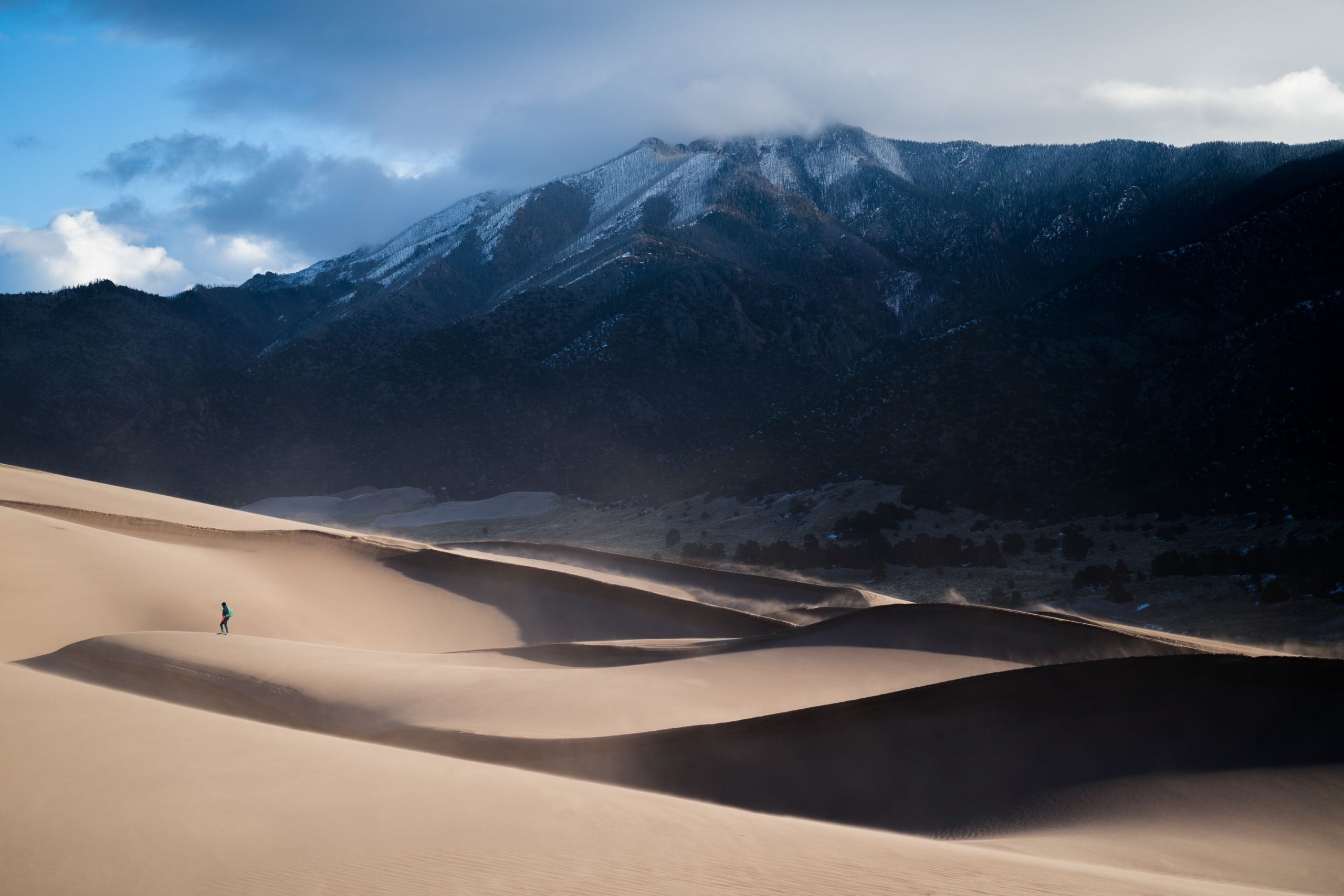
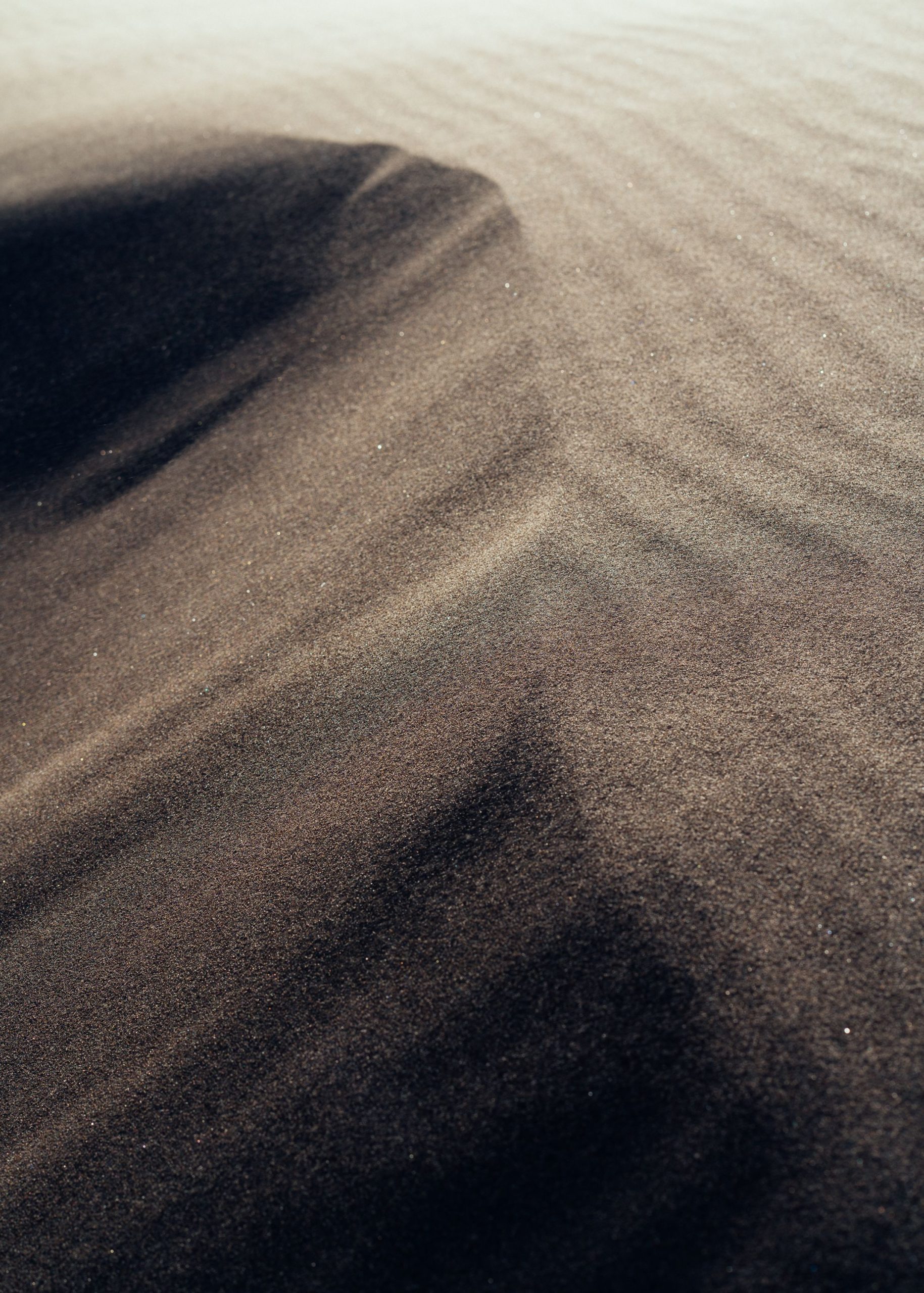
Another Dune, Great Sand Dunes NP, USA
Walking around the dunes felt like walking around on the sand planet in Star Wars, maybe just not as thirsty and exhausted and it wasn’t hot at all, I could see the snow covering the summits of the surrounding mountains.
Guadalupe Mountains National Park
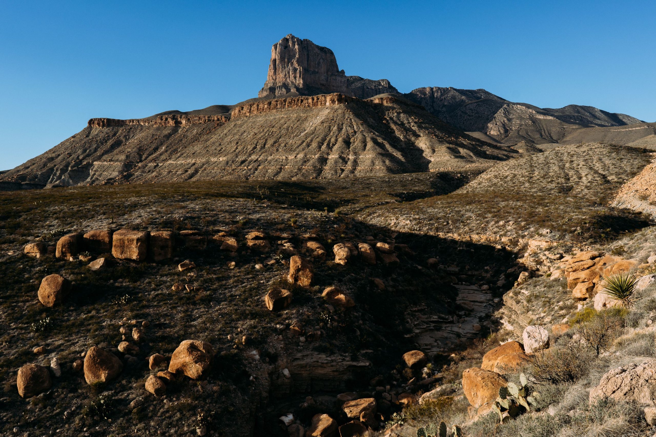
is an American national park in the Guadalupe Mountains, east of El Paso, Texas. The mountain range includes Guadalupe Peak, the highest point in Texas at 8,751 feet (2,667 m), and El Capitan used as a landmark by travellers on the route later followed by the Butterfield Overland Mail stagecoach line.
The ruins of a stagecoach station stand near the Pine Springs visitor centre. The restored Frijole Ranch contains a small museum of local history and is the trailhead for Smith Spring. The park covers 86,367 acres (134.9 sq mi; 349.5 km2] in the same mountain range as Carlsbad Caverns National Park, about 25 miles (40 km) to the north in New Mexico. The Guadalupe Peak Trail winds through pinyon pine and Douglas-fir forests as it ascends over 3,000 feet (910 m) to the summit of Guadalupe Peak, with views of El Capitan and the Chihuahuan Desert.
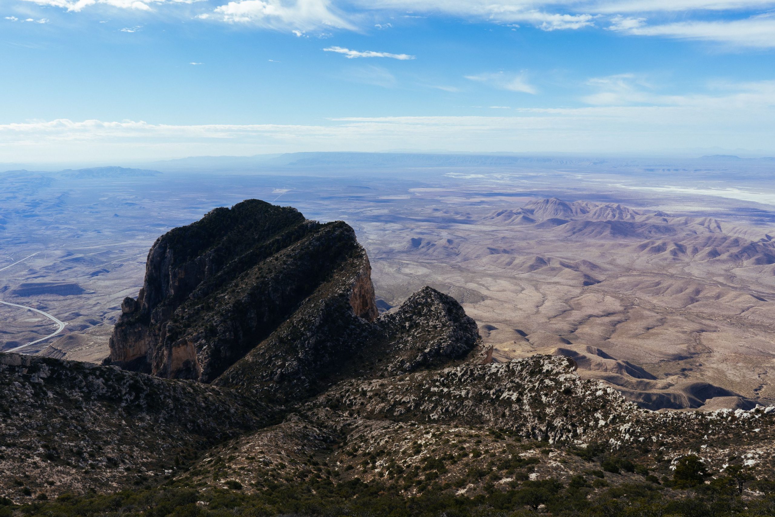
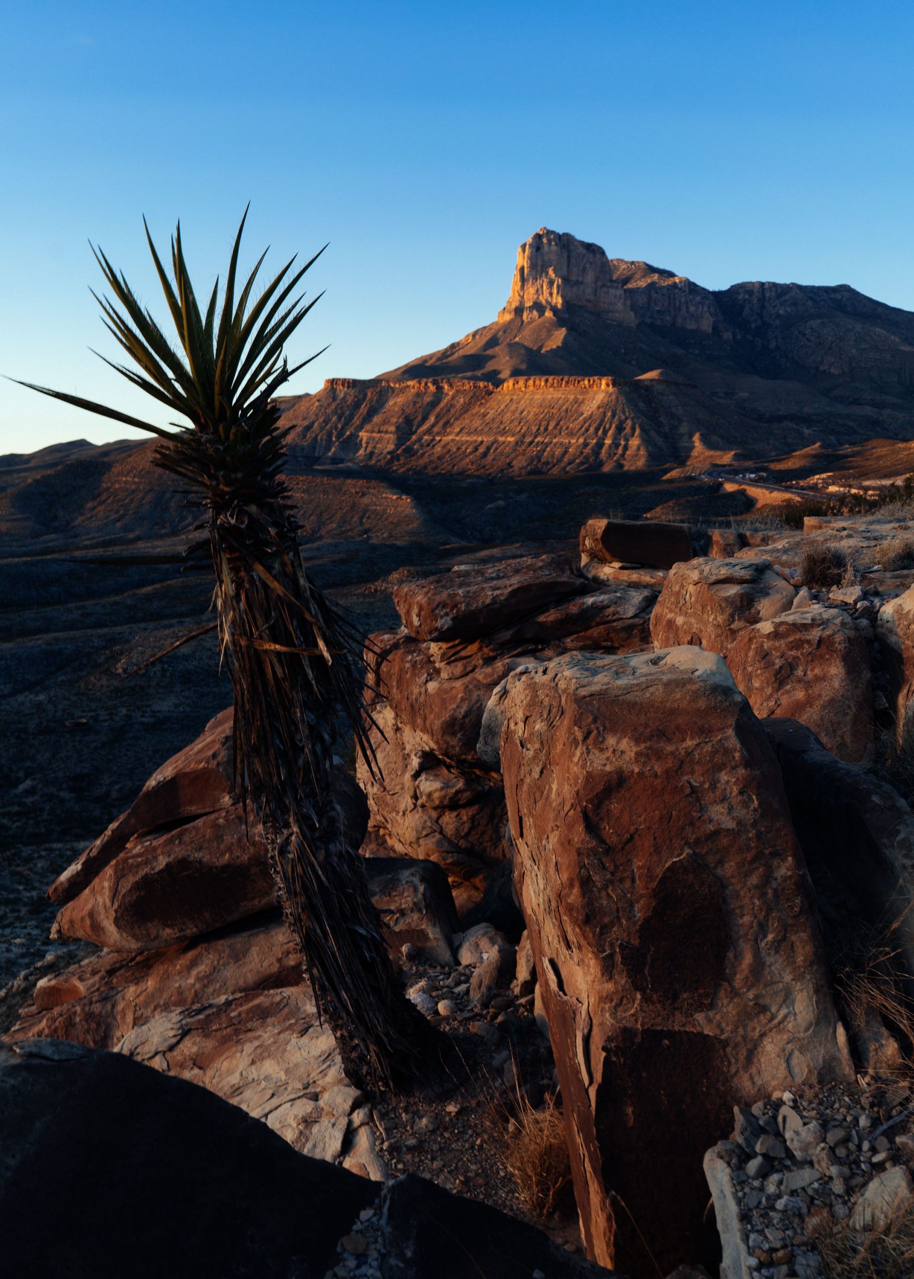
El Capitan, Guadalupe Mountains NP, USA
I didn’t really know what to do here, it was somewhat mid-day and this seemed to be a good option to kill a couple of hours. I did the hike to the summit of the El Capitan mesa. It was the iconic mesa that was the most photographed thing in the area, but from the valley. The hike wasn’t too exhausting and made for great views over the surrounding plains.
So finally, as I had tried what felt like too many times, it was time to leave the north and the cold, this time for good, my frosty little detour had been long enough. I set out for one of my longest drives of the drip, about 700km south in direction of new Mexico and Texas.
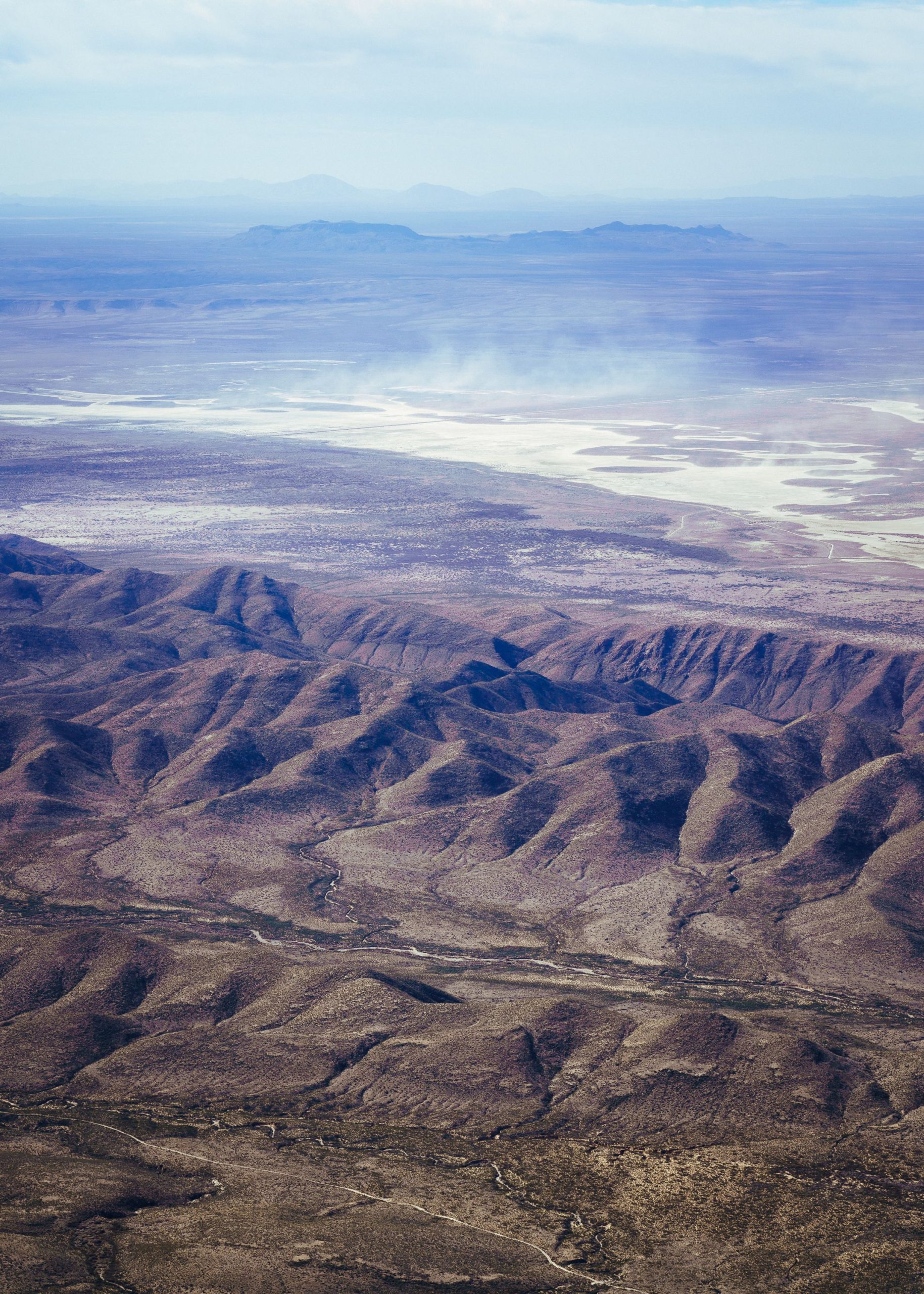
I passed through Roswell on the way and visited it’s Walmart, but to my surprise nothing extraordinary happened. I was a bit unsure of the next destination, I made it to the Guadalupe National park in Texas and was considering to visit Big bend National park, but it was just so far out in the middle of nowhere that I decided not to go in the end as it would’ve meant another 1000km on the meter. In no way I was doubting Eddies ability to go further but it felt a bit scary being so far away from everything. I had a little breakdown in the sense of not knowing where to go and what to do next. The options were go further south west to the big bend np, drive into Mexico or go left towards California. I hadn’t had proper food and sleep in a couple of days either, that always made everything a little harder.
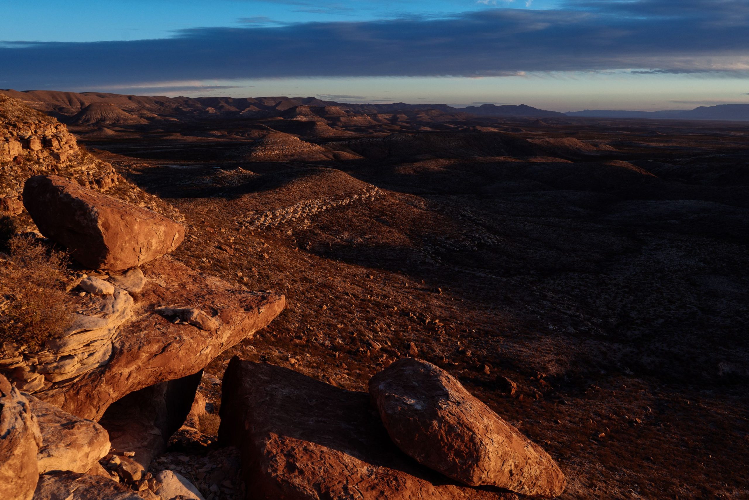
I stayed around the Guadalupe Mountains National park for a day, climbed the „El capitan“ mountain or Mesa and stumbled through the desert for sunset. It was a very remote park, no restaurants there, not even a petrolstation to get some coffee, which was a good excuse to get on my way as well.
Once I made the decision not to go down to the Big Bend NP or drive further into Mexico, but to drive over to El Paso and Las Cruces with the Californian route in mind instead, I started to feel a bit better. The shitty fast food and Walmart chocolate I got did a great job in filling me up and restoring some energy and happiness as well. I remember I was very hungry after the last few days, I did a few exhausting hikes but didn’t eat enough. I didn’t make it to Mexico in the end but I am pretty sure I was as close as I could get to the boarder in El Paso and I was going to California, which is somehow Mexico, at least it was once.
I felt like I had done half of the trip, it was time to turn around and drive back and finally lessen the distance between me and Vancouver. It had been bugging me, being so far away from my destination. Driving south towards Mexico form the Guadalupe national park was the furthest I had been away from my starting and supposed finish point. I didn’t want to go into Mexico as it would’ve involved a lot of trouble with the car, insurance, plates and the authorities. I decided to get over to the coast, visit California and drive up the 101 all the way back to Vancouver and visit some of the parks on the way. It felt great to finally turn around and have a plan for the last month of the trip and looking back at what I had done so far left me with a feeling of accomplishment.
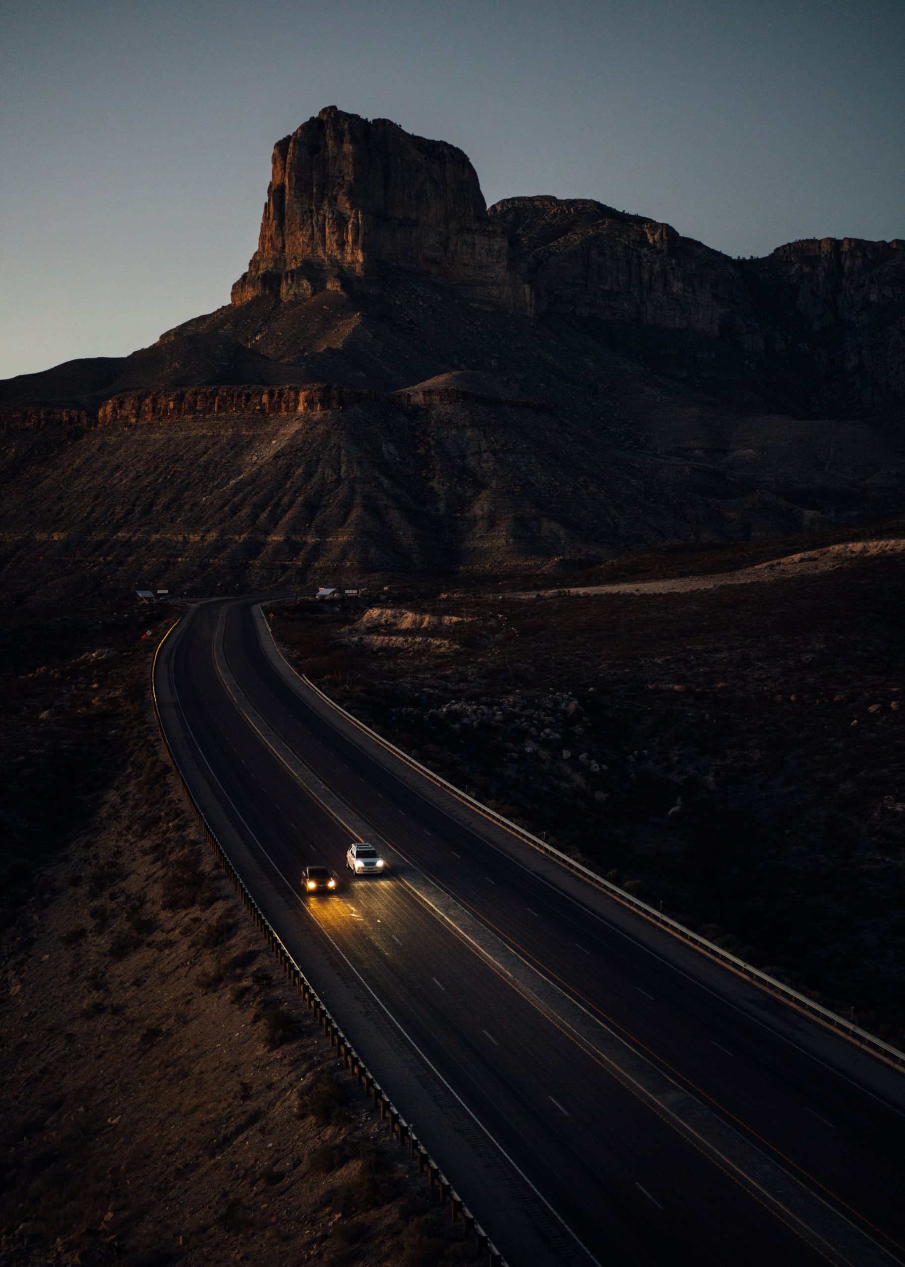
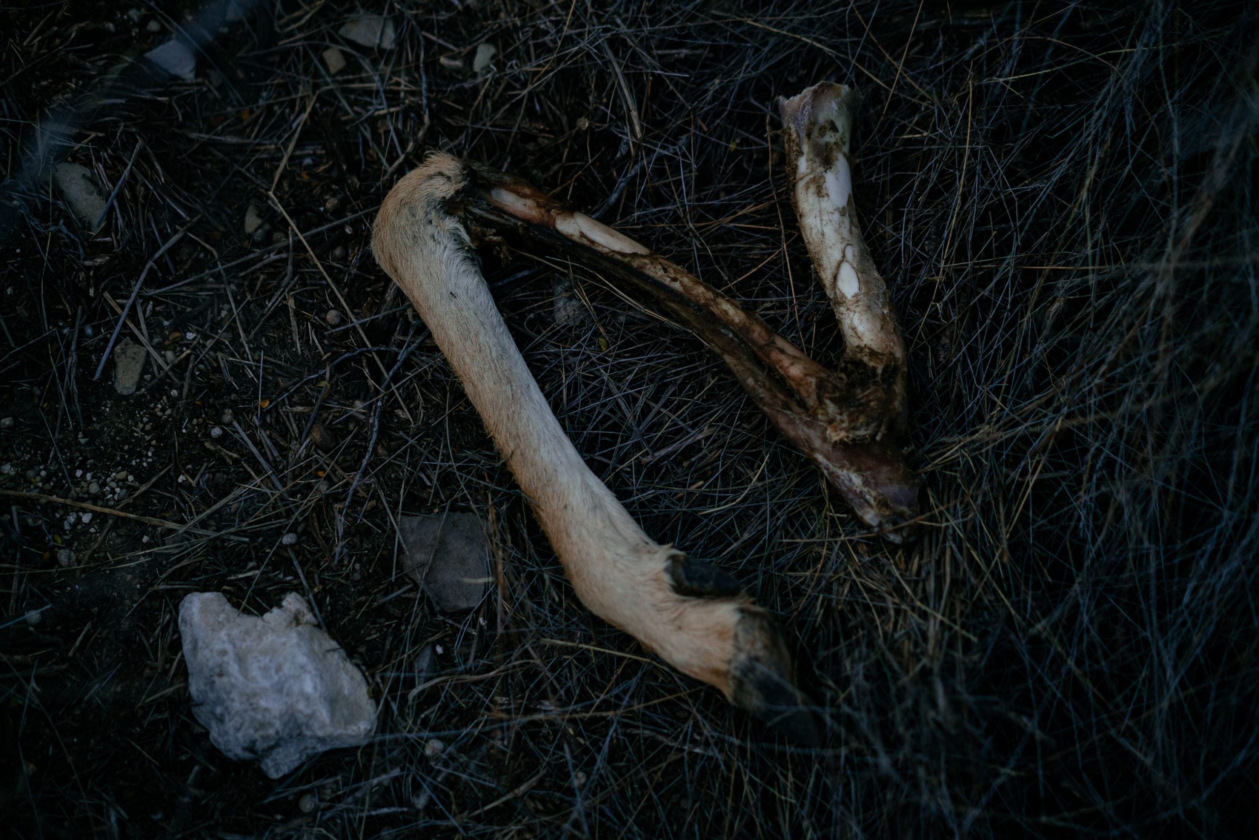
Race, Guadalupe Mountains NP, USA
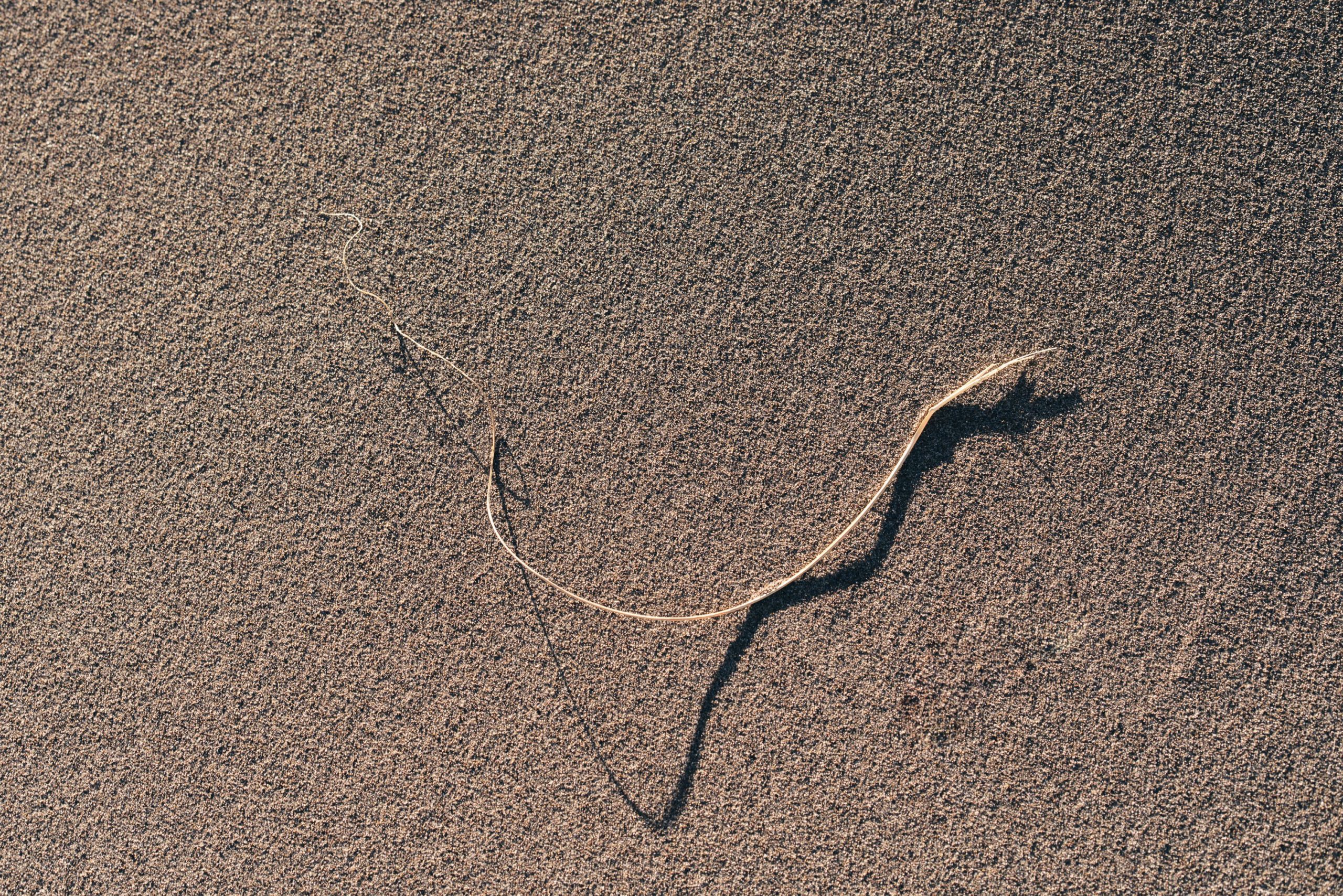
This is one of my favourite shots out of the Guadalupe Mountains NP. The El Capitan mesa in the background, two cars driving next to each other looking like they were racing. Reminds me of Namcos “Ridge Racer” a PlayStation game I played a lot as a kid, the ripped off leg in the gallery above might be able to relate, or how did this happen?